IMAGES TAKEN NEAR TO
Stannary, HALIFAX, HX4 9FD
Introduction
This page details the photographs taken nearby to Stannary, HX4 9FD by members of the Geograph project.
The Geograph project started in 2005 with the aim of publishing, organising and preserving representative images for every square kilometre of Great Britain, Ireland and the Isle of Man.

There are currently over 7.5m images from over14,400 individuals and you can help contribute to the project by visiting https://www.geograph.org.uk
Image Map
Images are licensed for reuse under creativecommons.org/licenses/by-sa/2.0
Notes
- Clicking on the map will re-center to the selected point.
- The higher the marker number, the further away the image location is from the centre of the postcode.
Image Listing (102 Images Found)
Images are licensed for reuse under creativecommons.org/licenses/by-sa/2.0
Image
Details
Distance
1
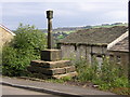
Stainland Cross, Stainland
An unusual cross in that it has St Andrew's cross at the top instead of the usual one. The explanation may be that the top of the cross, which looks relatively new, was put on when St Andrew's Church was built on the other side of the road.
Image: © Humphrey Bolton
Taken: 27 Sep 2006
0.01 miles
2
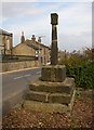
Stainland Cross
Another view of this cross. The shaft is considered to be of Saxon origin, but the head and base are later, 'medieval' according to the English Heritage listing.
Image: © Humphrey Bolton
Taken: 15 Oct 2007
0.01 miles
3
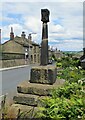
Village Cross
Across the road from the Church of St Andrew
Image: © Kevin Waterhouse
Taken: 20 Jun 2020
0.02 miles
4

Stainland Cross
Stone cross. Medieval. 3 steps formed of large slabs with square shaft tapering to
round section which supports a block carved on 4 sides with St. Andrew's cross in
relief. Listed Grade II.
Image: © Chris Allen
Taken: 16 Mar 2025
0.02 miles
5
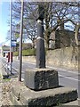
Old Wayside Cross by Stainland Road, Elland
Stainland Cross, old shaft, base and steps, by the UC road, in parish of Stainland (Calderdale District), Elland, Stainland Road, opposite church, head with St. Andrew's crosses on faces.
Grade II listed. List Entry Number: 1133961
https://historicengland.org.uk/listing/the-list/list-entry/1133961
Surveyed
Milestone Society National ID: YWCA_STA.
Image: © D Garside
Taken: 20 Apr 2010
0.02 miles
6

St Andrew's Church, Stainland
Built as an Independent Chapel, 1755 and enlarged and altered with addition of tower to the designs of Charles Child, in 1840, when taken over by the Church of England. Listed Grade II.
Image: © Chris Allen
Taken: 16 Mar 2025
0.02 miles
7

St. Andrew's Church, Stainland
Grade II Listed building dating back to around 1755
Image: © Chris Heaton
Taken: 28 Jul 2024
0.03 miles

9

Stainland Pharmacy - Stainland Road
Image: © Betty Longbottom
Taken: 2 Dec 2014
0.04 miles