
IMAGES TAKEN NEAR TO
Bank End, HALIFAX, HX4 8PR
Introduction
This page details the photographs taken nearby to Bank End, HX4 8PR by members of the Geograph project.
The Geograph project started in 2005 with the aim of publishing, organising and preserving representative images for every square kilometre of Great Britain, Ireland and the Isle of Man.

There are currently over 7.5m images from over14,400 individuals and you can help contribute to the project by visiting https://www.geograph.org.uk
Image Map
Images are licensed for reuse under creativecommons.org/licenses/by-sa/2.0
Notes
- Clicking on the map will re-center to the selected point.
- The higher the marker number, the further away the image location is from the centre of the postcode.
Image Listing (82 Images Found)
Images are licensed for reuse under creativecommons.org/licenses/by-sa/2.0
Image
Details
Distance
1

Old Bank End Farm, Greetland
A late 17C farmhouse, listed Grade II. This image is of the north side, of the 18C and 20C. The south side has the 17C work, but cannot be seen from the lane.
Image: © Humphrey Bolton
Taken: 7 Apr 2013
0.02 miles
2
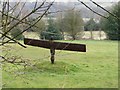
Sculpture at Bank End
This looks like a small version of a well known sculpture - a holiday souvenir?
Image: © Humphrey Bolton
Taken: 7 Apr 2013
0.05 miles
3
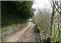
Dog Lane, Greetland
This is part of Elland Footpath 48, and is an access driveway to Bank End. On the left is a trimmed holly hedge. The small animal in the distance is a black cat, not a dog.
Image: © Humphrey Bolton
Taken: 7 Apr 2013
0.05 miles
4
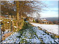
Elland FP48
The path goes along the lane to Bank End, and also left up stone steps to Rochdale Road.
Image: © Humphrey Bolton
Taken: 19 Jan 2015
0.06 miles
5
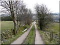
A branch of Elland Footpath 50, Greetland
This is on the driveway to Bank End, or perhaps more accurately the driveway was made on the line of the footpath.
Image: © Humphrey Bolton
Taken: 7 Apr 2013
0.06 miles
6
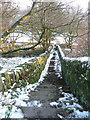
Steps on Elland FP48
This path was made in the second half of the 19C; it is on the 1893 1:2500 map but not on the 1850 six inch map.
Image: © Humphrey Bolton
Taken: 19 Jan 2015
0.06 miles
7
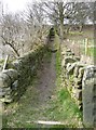
Elland Footpath 48, Greetland
This is the path down from Rochdale Road opposite the Norland Road junction.
Image: © Humphrey Bolton
Taken: 7 Apr 2013
0.06 miles
8
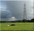
Sheep, hole and pylon, Greetland
On guard.
Image: © Humphrey Bolton
Taken: 2 Oct 2008
0.07 miles
9

Elder tree on Elland Footpath 49
This old tree looks rather spooky. Some of the branches have died.
Image: © Humphrey Bolton
Taken: 7 Apr 2013
0.07 miles
10
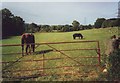
Field with horse and pony near Greetland Wall, West Yorkshire
Image: © nick macneill
Taken: 25 Aug 2003
0.08 miles