IMAGES TAKEN NEAR TO
Ravenswood, Scar Bottom Lane, HALIFAX, HX4 8PQ
Introduction
This page details the photographs taken nearby to Ravenswood, Scar Bottom Lane, HX4 8PQ by members of the Geograph project.
The Geograph project started in 2005 with the aim of publishing, organising and preserving representative images for every square kilometre of Great Britain, Ireland and the Isle of Man.

There are currently over 7.5m images from over14,400 individuals and you can help contribute to the project by visiting https://www.geograph.org.uk
Image Map (Loading...)


Getting Data...Please wait
Leaflet Map data © OpenStreetMap
Images are licensed for reuse under creativecommons.org/licenses/by-sa/2.0
Notes
- Clicking on the map will re-center to the selected point.
- The higher the marker number, the further away the image location is from the centre of the postcode.
Image Listing (82 Images Found)
Images are licensed for reuse under creativecommons.org/licenses/by-sa/2.0
Image
Details
Distance
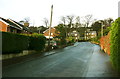
1
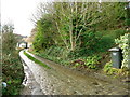
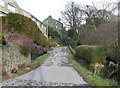
Scar Bottom Lane, Greetland
Above the junction with Brian Royd Lane Scar Bottom Lane is narrow and roughly surfaced.
Image: © Humphrey Bolton
Taken: 11 Mar 2013
0.02 miles
2
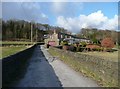
Driveway to the former Scar Bottom Mills
The bottom end of Elland FP42 is just to the left of the 'wheely' bin.
Image: © Humphrey Bolton
Taken: 9 Jan 2014
0.02 miles
3
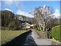
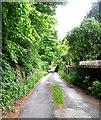
Scar Bottom Lane, Greetland
Looking up towards some modern houses under the 'scar'. Rochdale Road runs along the top.
Image: © Humphrey Bolton
Taken: 11 Mar 2013
0.03 miles
4
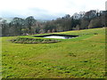
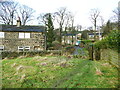
The reservoir of the former Scar Mill, Greetland
Scar Mill (Woollen) is shown on the 1930s 1:2500 map, but the previous editions, 1893 and 1907, show it as 'Saltaire Mill (disused)' and it had gone by the 1960s. It is not on the 1850 six-inch map (although a building is shown but not captioned) so only had short periods of use and seems to have been unsuccessful.
Image: © Humphrey Bolton
Taken: 9 Jan 2014
0.06 miles
5
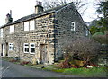
Brook Row, Greetland
A row of cottages shown and named on the 1850 six-inch map.The stone trough to the right is probably their original water supply.
Image: © Humphrey Bolton
Taken: 9 Jan 2014
0.07 miles
6
Scar Bottom Lane, Greetland
The top end of the lane slants down from Rochdale Road, onto which the upper two storeys of the tall houses (Scar Top) face.
Image: © Humphrey Bolton
Taken: 11 Mar 2013
0.07 miles
7
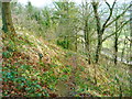
Elland FP42 (SE part)
Somewhere up on the left, the OS map shows a disused quarry face, Scarbottom Delf. This view is just below the steps in Image
Image: © Humphrey Bolton
Taken: 6 Jan 2014
0.07 miles
8
Scarbottom Lane - Rochdale Road, Greetland
Image: © Betty Longbottom
Taken: 21 May 2008
0.07 miles
9
Stile on Elland FP52 at Brook Row
Beyond the stile the path goes along the driveway to the cottages to Brian Royd Lane.
Image: © Humphrey Bolton
Taken: 9 Jan 2014
0.07 miles
10
Trenance Gardens, Greetland
An estate built on land between Brian Royde and Brian Royd Mills.
Image: © Humphrey Bolton
Taken: 9 Jan 2014
0.08 miles