
IMAGES TAKEN NEAR TO
Green Lane, HALIFAX, HX4 8DD
Introduction
This page details the photographs taken nearby to Green Lane, HX4 8DD by members of the Geograph project.
The Geograph project started in 2005 with the aim of publishing, organising and preserving representative images for every square kilometre of Great Britain, Ireland and the Isle of Man.

There are currently over 7.5m images from over14,400 individuals and you can help contribute to the project by visiting https://www.geograph.org.uk
Image Map
Images are licensed for reuse under creativecommons.org/licenses/by-sa/2.0
Notes
- Clicking on the map will re-center to the selected point.
- The higher the marker number, the further away the image location is from the centre of the postcode.
Image Listing (191 Images Found)
Images are licensed for reuse under creativecommons.org/licenses/by-sa/2.0
Image
Details
Distance
1
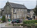
Former school, Green Lane, West Vale
This was the original St Patricks catholic school before a new school was built at Hullen Edge. The pupils entered by the Green lane entrance. The nuns who taught there lived in the large house at the bottom of (old) Feather Bed Lane just above Workhouse Lane. It is captioned 'Convent' on the large-scale OS map.
Image: © Humphrey Bolton
Taken: 16 Apr 2010
0.03 miles
4
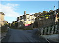
St Patrick's Convent, West Vale
The name in title is the caption on one version of the large scale OS map. Another just has 'Convent' and a sign outside the building reads 'Sisters of St Joseph'.
Image: © Humphrey Bolton
Taken: 7 Nov 2013
0.06 miles
5
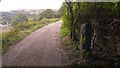
Gatepost and remains of iron gate on Nab End Lane, West Vale
The gate had not been in use for a long time.
Image: © Phil Champion
Taken: 31 Jul 2018
0.06 miles
6
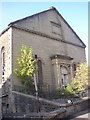
Middle Dean Street Chapel, West Vale, Greetland
The plaque reads Middle Dean Street Chapel 1865, with 'Middle' in Gothic lettering for some reason. This was a Wesleyan Methodist Chapel, one of two in West Vale. It was the West Vale Squash Club when this photograph was taken, but has since been converted to apartments.
Image: © Humphrey Bolton
Taken: Unknown
0.07 miles
7
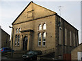
Former chapel, Green Lane
The building bears the name Middle Dean Street Chapel but fronts onto Green Lane. According to a site visitor, it has been converted to luxury apartments, despite the closed appearance given by the blocked up windows.
Image: © Stephen Craven
Taken: 4 Jan 2011
0.07 miles
8
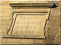
Chapel date stone
The stone is inscribed "Middle Dean Street Chapel 1865". For context, see Image
Image: © Stephen Craven
Taken: 4 Jan 2011
0.07 miles
9
Junction of Workhouse Lane and Nab End Lane
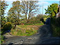
Workhouse Lane is the lane going up to the right. It is an adopted highway and leads to a terrace of houses but existed before they were built. There was a workhouse in this area for a while in the early 19C. It was closed and the people moved to the Union workhouse in Halifax. The only building shown on the 1850 OS map is at Wood Side. Nab End Lane is an old route between Elland and Greetland, and is shown on the 1850 map. It is an unadopted lane and Elland FP32.
Image: © Humphrey Bolton
Taken: 7 Nov 2013
0.07 miles
10
Post Office, Saddleworth Road, Greetland
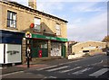
The postbox does not carry a royal cypher. To the right of it are two disused stamp vending machines. For many years these were in use outside most post offices, selling booklets for gradually increasing sums (I started at 1/-, and they went out of use at £1). There are still some modern machines that sell any number of 2nd or 1st class stamps from coils, and will give change.
Image: © Humphrey Bolton
Taken: 15 Oct 2007
0.07 miles