
IMAGES TAKEN NEAR TO
Branch Road, HALIFAX, HX4 0AA
Introduction
This page details the photographs taken nearby to Branch Road, HX4 0AA by members of the Geograph project.
The Geograph project started in 2005 with the aim of publishing, organising and preserving representative images for every square kilometre of Great Britain, Ireland and the Isle of Man.

There are currently over 7.5m images from over14,400 individuals and you can help contribute to the project by visiting https://www.geograph.org.uk
Image Map
Images are licensed for reuse under creativecommons.org/licenses/by-sa/2.0
Notes
- Clicking on the map will re-center to the selected point.
- The higher the marker number, the further away the image location is from the centre of the postcode.
Image Listing (33 Images Found)
Images are licensed for reuse under creativecommons.org/licenses/by-sa/2.0
Image
Details
Distance
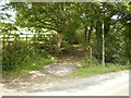
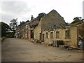
3
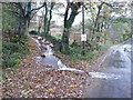
Stream flow on Wood End Lane at Branch Road, Greetland
I came down the lane, and was glad that I had opted for water sports shoes today. The flow comes down a channel at the side of the lane further up, and presumably should go into a culvert. I was interested to see that the torrent coming down the track somehow seems to disappear into a flat sheet of water when it reaches the road.
Image: © Humphrey Bolton
Taken: 9 Nov 2015
0.05 miles
4
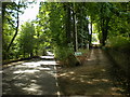
Branch Road
With the road to Wood End Farm on the right
Image: © Alexander P Kapp
Taken: 7 Sep 2009
0.07 miles
5
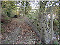
Bridleway at Wood End, Barkisland
This bridleway joins Branch Road to Saddleworth Road B6114, although it could be older than either as the stone pitching would have been laid for packhorses before the turnpike roads were built.
Image: © Humphrey Bolton
Taken: 11 Nov 2004
0.07 miles
6

Branch Road at a branch of Ripponden FP75
This path is on a track into Zechariah Wood. The gates are fastened together to make a fence, but there is a gap at the far end next to the footpath signpost, see Image
Image: © Humphrey Bolton
Taken: 8 Jan 2015
0.08 miles
7
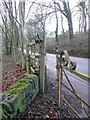
Gap-stile at Branch Road on a branch of Ripponden FP75
A wide gap between the footpath signpost and an old metal gate.
Image: © Humphrey Bolton
Taken: 8 Jan 2015
0.08 miles
8
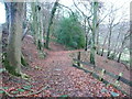
Footpath through Zechariah Wood
This is a branch of Ripponden FP75, going down to the main path by the side of Black Brook. The wood and track are shown on the 1850 six-inch map, but not the continuation into the valley, which is first shown on the 1893 1:2500 map.
See also Image
Image: © Humphrey Bolton
Taken: 8 Jan 2015
0.10 miles
9
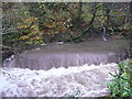
The Black Brook in spate at a weir, Greetland
Although sensible people stay at home, it can be interesting to venture out when it is raining, and has been for most of the last two days.
Image: © Humphrey Bolton
Taken: 9 Nov 2015
0.14 miles
10
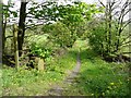
Wood End Lane, Barkisland
At the junction with Saddleworth Road. The wall on the left side of the lane is the boundary with Greetland, and the 1850 map shows a boundary stone on the corner. The stone there now is nicely shaped, but does not seem to have an inscription.
Image: © Humphrey Bolton
Taken: 16 May 2013
0.15 miles