IMAGES TAKEN NEAR TO
Woodhall Park, HALIFAX, HX3 7RU
Introduction
This page details the photographs taken nearby to Woodhall Park, HX3 7RU by members of the Geograph project.
The Geograph project started in 2005 with the aim of publishing, organising and preserving representative images for every square kilometre of Great Britain, Ireland and the Isle of Man.

There are currently over 7.5m images from over14,400 individuals and you can help contribute to the project by visiting https://www.geograph.org.uk
Image Map
Images are licensed for reuse under creativecommons.org/licenses/by-sa/2.0
Notes
- Clicking on the map will re-center to the selected point.
- The higher the marker number, the further away the image location is from the centre of the postcode.
Image Listing (78 Images Found)
Images are licensed for reuse under creativecommons.org/licenses/by-sa/2.0
Image
Details
Distance
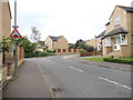
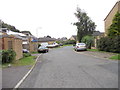
1
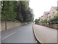
Hall Lane - viewed from Upper Hall View
Image: © Betty Longbottom
Taken: 13 Aug 2012
0.03 miles
2
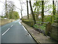
Hall Lane, Northowram
The stile on the right leads to the footpath in Image
Image: © Humphrey Bolton
Taken: 2 May 2016
0.04 miles
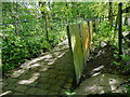
3
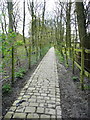
Footpath to Upper lane and Four Lane Ends, Norrthowram
This is the path leaving Hall Lane.
Image: © Humphrey Bolton
Taken: 2 May 2016
0.04 miles
5
The eastern end of the stone slab wall off Hall Lane, Northowram
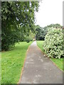
This wall is alongside the footpath from Hall Lane to Upper Lane. It must originally have started at Hall Lane, as the listing details (1996) state that it was 174m long and was complete apart from minor damage. The listing has not done much good as about 30m is missing from the Hall Lane end and there are many gaps where slabs have fallen or been broken. The wall was built c.1780. The path is paved with stone setts.
Image: © Humphrey Bolton
Taken: 22 May 2021
0.05 miles
6
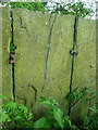
Close view of stone slab wall showing iron fixings, Northowram
The fixings are rather small, and were perhaps not expected to last 240 years. The weakness of this type of wall is that it relies on the ground staying firm enough to stop the slabs from falling over. Fastening them together with iron plates helps, but the iron rusts and the stone slabs around the plates. Many of the slabs have broken, either due to vandalism or the action of frost getting into cracks.
Image: © Humphrey Bolton
Taken: 22 May 2021
0.05 miles
7
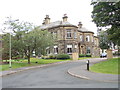
Sinderhill Court - viewed from Wytehill Chase
Image: © Betty Longbottom
Taken: 13 Aug 2012
0.06 miles
9
Electricity Substation No 3509 - Upper Hall View
Image: © Betty Longbottom
Taken: 13 Aug 2012
0.06 miles