IMAGES TAKEN NEAR TO
Brow Lane, HALIFAX, HX3 7QL
Introduction
This page details the photographs taken nearby to Brow Lane, HX3 7QL by members of the Geograph project.
The Geograph project started in 2005 with the aim of publishing, organising and preserving representative images for every square kilometre of Great Britain, Ireland and the Isle of Man.

There are currently over 7.5m images from over14,400 individuals and you can help contribute to the project by visiting https://www.geograph.org.uk
Image Map
Images are licensed for reuse under creativecommons.org/licenses/by-sa/2.0
Notes
- Clicking on the map will re-center to the selected point.
- The higher the marker number, the further away the image location is from the centre of the postcode.
Image Listing (135 Images Found)
Images are licensed for reuse under creativecommons.org/licenses/by-sa/2.0
Image
Details
Distance
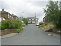
3
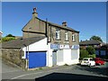
IHCS, Brow Lane
The acronym stands for Independent Health Care Solutions.
Image: © Stephen Craven
Taken: 10 Jul 2022
0.04 miles
6
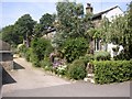
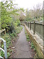
Lane off Brow Lane, Shelf
This has no name, unless there is one on the row of cottages. It passes the pinfold before becoming a footpath up steps to Wade House Road.
Image: © Humphrey Bolton
Taken: 25 Jul 2006
0.06 miles
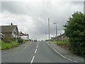
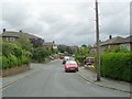
9
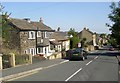
Top end of Brow Lane, Shelf
The old house on the left is dated 1799, with the initials LJS.
Image: © Humphrey Bolton
Taken: 24 Jul 2006
0.07 miles
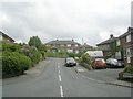
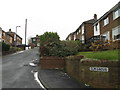
10
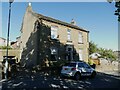
Brow Lane Villa
The house bears a datestone of 1882.
Image: © Stephen Craven
Taken: 10 Jul 2022
0.07 miles