IMAGES TAKEN NEAR TO
Danum Terrace, HALIFAX, HX3 7EH
Introduction
This page details the photographs taken nearby to Danum Terrace, HX3 7EH by members of the Geograph project.
The Geograph project started in 2005 with the aim of publishing, organising and preserving representative images for every square kilometre of Great Britain, Ireland and the Isle of Man.

There are currently over 7.5m images from over14,400 individuals and you can help contribute to the project by visiting https://www.geograph.org.uk
Image Map
Images are licensed for reuse under creativecommons.org/licenses/by-sa/2.0
Notes
- Clicking on the map will re-center to the selected point.
- The higher the marker number, the further away the image location is from the centre of the postcode.
Image Listing (176 Images Found)
Images are licensed for reuse under creativecommons.org/licenses/by-sa/2.0
Image
Details
Distance
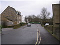
2
8-9 Tetley Lane
The 17th century house is listed grade II (list entry 1258962). The listing says it dates from '1687 (not now visible)', a date repeated in the conservation area appraisal, but above the door it currently says '1681' Image
Image: © Stephen Craven
Taken: 12 Mar 2022
0.04 miles
3
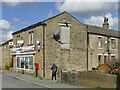
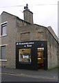
Go Local, Towngate, Northowram
A convenience store incorporating a sub post office, hence the postbox outside. Formerly called 'Lifestyle Express' Image The gable end of the building has a doorway and lifting beam at first floor level, indicating a former use as a warehouse or workshop.
Image: © Stephen Craven
Taken: 12 Mar 2022
0.04 miles
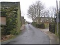
4

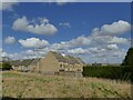
Old barn, Tetley Lane, Northowram
The slate roof of this building has failed. According to Calderdale Council's Conservation Area Plan, this is the last remaining stone barn of several once found around Towngate (the old heart of the village), characterised by "stone walling and large catslide roofs of natural stone slate".
Image: © Stephen Craven
Taken: 12 Mar 2022
0.05 miles
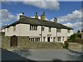
6
Haven Close, Northowram
A modern development, seen from Upper Lane.
Image: © Stephen Craven
Taken: 12 Mar 2022
0.05 miles
8
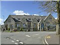
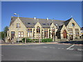
Former Primary School, Northowram Green
Built in 1874 as a Mechanics Institute, it became a Board School in 1891 and remained as a primary school until a new facility was erected on the fields behind in 1996 Image It has now been converted to apartments, which is more evident from the rear Image
Image: © Stephen Craven
Taken: 12 Mar 2022
0.05 miles
9
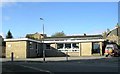
Northowram Library - St Matthew's Drive
Image: © Betty Longbottom
Taken: 17 Oct 2007
0.05 miles