
IMAGES TAKEN NEAR TO
Upper Lane, HALIFAX, HX3 7EE
Introduction
This page details the photographs taken nearby to Upper Lane, HX3 7EE by members of the Geograph project.
The Geograph project started in 2005 with the aim of publishing, organising and preserving representative images for every square kilometre of Great Britain, Ireland and the Isle of Man.

There are currently over 7.5m images from over14,400 individuals and you can help contribute to the project by visiting https://www.geograph.org.uk
Image Map
Images are licensed for reuse under creativecommons.org/licenses/by-sa/2.0
Notes
- Clicking on the map will re-center to the selected point.
- The higher the marker number, the further away the image location is from the centre of the postcode.
Image Listing (165 Images Found)
Images are licensed for reuse under creativecommons.org/licenses/by-sa/2.0
Image
Details
Distance

2
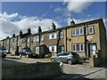
Shepherds Fold, Northowram
A terrace of stone houses occupying part of one long side of a long, narrow plot that was probably originally a one acre field. See also Image
Image: © Stephen Craven
Taken: 12 Mar 2022
0.01 miles
3
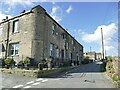
Upper Lane, Northowram
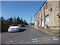
From the junction with Tetley Lane. The corner building with a blocked door on the rounded corner might have been a shop at one time.
Image: © Stephen Craven
Taken: 12 Mar 2022
0.01 miles
4
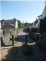
Footpath (Baxter Lane) - Upper Lane
Image: © Betty Longbottom
Taken: 5 Sep 2012
0.04 miles
5
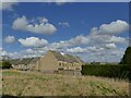
Haven Close, Northowram
A modern development, seen from Upper Lane.
Image: © Stephen Craven
Taken: 12 Mar 2022
0.04 miles
6

Baxter Lane Works, Northowram
The 1893 OS map shows baxter Farm here, so this was presumably a barn, later adapted for industrial use. The blocked lunette windows look interesting, especially the one on the left with three small holes that might have been for pigeons.
Image: © Humphrey Bolton
Taken: 16 Jul 2010
0.04 miles
7

Baxter Lane, Northowram
This is the top end off Upper Lane. The lane was evidently considered to be too narrow for through traffic, and has been classified as a bridleway although it gives access to several houses.
Image: © Humphrey Bolton
Taken: 16 Jul 2010
0.04 miles

10
Baxter Lane, Northowram
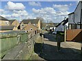
A narrow road, closed to motor traffic at this western end, and with the status of a public bridleway. See also Image
Image: © Stephen Craven
Taken: 12 Mar 2022
0.05 miles