
IMAGES TAKEN NEAR TO
New Lane, HALIFAX, HX3 0TE
Introduction
This page details the photographs taken nearby to New Lane, HX3 0TE by members of the Geograph project.
The Geograph project started in 2005 with the aim of publishing, organising and preserving representative images for every square kilometre of Great Britain, Ireland and the Isle of Man.

There are currently over 7.5m images from over14,400 individuals and you can help contribute to the project by visiting https://www.geograph.org.uk
Image Map
Images are licensed for reuse under creativecommons.org/licenses/by-sa/2.0
Notes
- Clicking on the map will re-center to the selected point.
- The higher the marker number, the further away the image location is from the centre of the postcode.
Image Listing (131 Images Found)
Images are licensed for reuse under creativecommons.org/licenses/by-sa/2.0
Image
Details
Distance
1
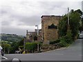
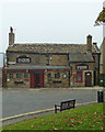
The former Commercial Inn, Skircoat Green
Image: © Michael Steele
Taken: 23 Aug 2009
0.04 miles
2
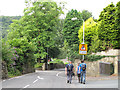
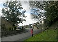
Walking to the Tour - Copley Lane
A few of the many people walking across Calderdale that morning to watch the Tour de France come through. Here passing the end of Springwood Drive.
Image: © Stephen Craven
Taken: 6 Jul 2014
0.06 miles
4
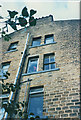
Tall house on Lower Skircoat Green
Some of the houses on the steep hillsides of the Calder Valley are "top and bottom" - four storeys, the top two accessed from an upper road and the bottom two a separate dwelling accessed from the lower road.
Image: © Stephen Craven
Taken: 25 Aug 1990
0.06 miles
6
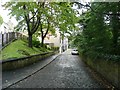
Cow Lane, Skircoat
This is the western end of the lane, where it meets Copley Lane. This is the widest part of the lane, which is a footpath in its central section.
Image: © Humphrey Bolton
Taken: 8 Sep 2011
0.07 miles
7
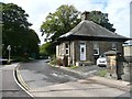
Ravenscliffe Lodge, Skircoat
This was the lodge for a mansion, no longer existing, called Bermerside. It became a 'Home and School' according to the 1930s six-inch map. It has now been given the same name as the road, which leads to Ravenscliffe High School and some blocks of flats.
Image: © Humphrey Bolton
Taken: 8 Sep 2011
0.08 miles
9
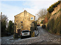
Top of Cow Lane
This upper part of Cow Lane (both branches of the road in this photo being so named on the map) is surfaced with setts and open to vehicles.
Image: © Stephen Craven
Taken: 4 Jan 2011
0.09 miles
10
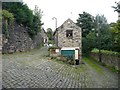
Cow Lane, Skircoat
Here two cobbled lanes run parallel, with a ramp between them. Cow Lane is the one on the right.
Image: © Humphrey Bolton
Taken: 8 Sep 2011
0.10 miles