IMAGES TAKEN NEAR TO
Green Park Road, HALIFAX, HX3 0SN
Introduction
This page details the photographs taken nearby to Green Park Road, HX3 0SN by members of the Geograph project.
The Geograph project started in 2005 with the aim of publishing, organising and preserving representative images for every square kilometre of Great Britain, Ireland and the Isle of Man.

There are currently over 7.5m images from over14,400 individuals and you can help contribute to the project by visiting https://www.geograph.org.uk
Image Map
Images are licensed for reuse under creativecommons.org/licenses/by-sa/2.0
Notes
- Clicking on the map will re-center to the selected point.
- The higher the marker number, the further away the image location is from the centre of the postcode.
Image Listing (151 Images Found)
Images are licensed for reuse under creativecommons.org/licenses/by-sa/2.0
Image
Details
Distance
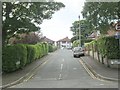
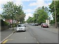
3
Green Park Road - viewed from Green Park Street
Image: © Betty Longbottom
Taken: 26 Jul 2013
0.05 miles
4
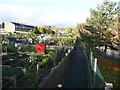
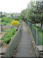
Footpath past allotments, Skircoat, Halifax
This path goes straight from Godfrey Road to Dryclough Lane, with allotments on the left and the hospital on the right.
Image: © Humphrey Bolton
Taken: 4 Nov 2016
0.06 miles
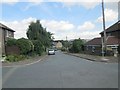
5
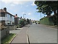
Green Park Avenue - Green Park Road
Image: © Betty Longbottom
Taken: 26 Jul 2013
0.06 miles
6
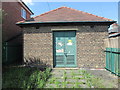
Electricity Substation No 391 - Green Park Street
Image: © Betty Longbottom
Taken: 26 Jul 2013
0.06 miles
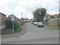
7
Green Park Street - Green Park Road
Image: © Betty Longbottom
Taken: 26 Jul 2013
0.07 miles
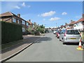
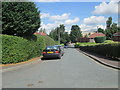
9
Godfrey Road - viewed from Green Park Street
Image: © Betty Longbottom
Taken: 31 May 2013
0.08 miles