IMAGES TAKEN NEAR TO
Popples Drive, HALIFAX, HX2 9SQ
Introduction
This page details the photographs taken nearby to Popples Drive, HX2 9SQ by members of the Geograph project.
The Geograph project started in 2005 with the aim of publishing, organising and preserving representative images for every square kilometre of Great Britain, Ireland and the Isle of Man.

There are currently over 7.5m images from over14,400 individuals and you can help contribute to the project by visiting https://www.geograph.org.uk
Image Map (Loading...)


Getting Data...Please wait
Leaflet Map data © OpenStreetMap
Images are licensed for reuse under creativecommons.org/licenses/by-sa/2.0
Notes
- Clicking on the map will re-center to the selected point.
- The higher the marker number, the further away the image location is from the centre of the postcode.
Image Listing (64 Images Found)
Images are licensed for reuse under creativecommons.org/licenses/by-sa/2.0
Image
Details
Distance
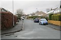
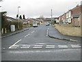
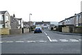
2
Tewit Green - looking towards Popples Drive
Image: © Betty Longbottom
Taken: 24 Feb 2014
0.06 miles
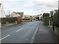
5
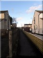
Footpath between Wentworth Drive and Lindrick Way
Image: © Michael Steele
Taken: 6 Dec 2009
0.09 miles
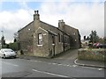
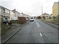
6
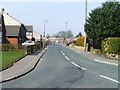
Tewit Lane from School Lane, Illingworth, Halifax
Image: © Michael Steele
Taken: 21 Mar 2009
0.09 miles
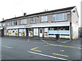
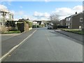
10
Illingworth Drive - Illingworth Road
Image: © Betty Longbottom
Taken: 24 Feb 2014
0.11 miles