IMAGES TAKEN NEAR TO
Brickfield Lane, HALIFAX, HX2 9AU
Introduction
This page details the photographs taken nearby to Brickfield Lane, HX2 9AU by members of the Geograph project.
The Geograph project started in 2005 with the aim of publishing, organising and preserving representative images for every square kilometre of Great Britain, Ireland and the Isle of Man.

There are currently over 7.5m images from over14,400 individuals and you can help contribute to the project by visiting https://www.geograph.org.uk
Image Map
Images are licensed for reuse under creativecommons.org/licenses/by-sa/2.0
Notes
- Clicking on the map will re-center to the selected point.
- The higher the marker number, the further away the image location is from the centre of the postcode.
Image Listing (68 Images Found)
Images are licensed for reuse under creativecommons.org/licenses/by-sa/2.0
Image
Details
Distance
1
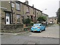
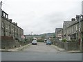
Brickfield Terrace - Brickfield Lane
Image: © Betty Longbottom
Taken: 16 Oct 2013
0.02 miles
2
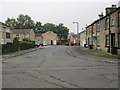
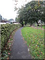
Brickfield Grove - Brickfield Lane
Image: © Betty Longbottom
Taken: 16 Oct 2013
0.03 miles
3
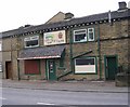
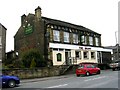
Far Isle Farm Shop - Shay Lane, Holmfield
Image: © Betty Longbottom
Taken: 25 Mar 2008
0.03 miles
4
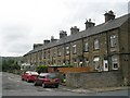
Baker Street North - Beechwood Road
Image: © Betty Longbottom
Taken: 24 Aug 2009
0.04 miles
9
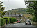
Beechwood Road, Holmfield
Looking down the road from outside St Andrew's church.
Image: © Stephen Craven
Taken: 14 Aug 2019
0.06 miles
10
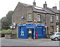
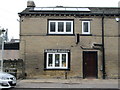
Lifestyle Express - Shay Lane
This was formerly a post office.
Image: © Betty Longbottom
Taken: 16 Oct 2013
0.06 miles