IMAGES TAKEN NEAR TO
Shay Lane, HALIFAX, HX2 9AD
Introduction
This page details the photographs taken nearby to Shay Lane, HX2 9AD by members of the Geograph project.
The Geograph project started in 2005 with the aim of publishing, organising and preserving representative images for every square kilometre of Great Britain, Ireland and the Isle of Man.

There are currently over 7.5m images from over14,400 individuals and you can help contribute to the project by visiting https://www.geograph.org.uk
Image Map (Loading...)


Getting Data...Please wait
Leaflet Map data © OpenStreetMap
Images are licensed for reuse under creativecommons.org/licenses/by-sa/2.0
Notes
- Clicking on the map will re-center to the selected point.
- The higher the marker number, the further away the image location is from the centre of the postcode.
Image Listing (71 Images Found)
Images are licensed for reuse under creativecommons.org/licenses/by-sa/2.0
Image
Details
Distance
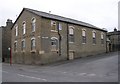
2
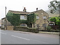
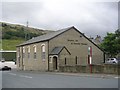
Kingdom Hall of the Jehovah's Witnesses, Shay Lane, Halifax
This building is captioned 'Sunday School' on old 1:2500 maps, and was refurbished by the Jehovah's Witnesses in 1994. It might also have been used as a chapel, as there do not seem to have been any chapels nearby. The 'place of worship' to the west is St Andrew's (Anglican) Church, built in 1897, which had its own Sunday School (now demolished).
Image: © Humphrey Bolton
Taken: 9 Oct 2008
0.02 miles
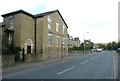
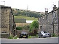
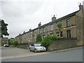
4
Stanley Street North - Beechwood Road
Image: © Betty Longbottom
Taken: 24 Aug 2009
0.02 miles
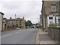
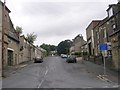
5
Kingdom Hall of Jehovah's Witnesses - Beechwood Road
Image: © Betty Longbottom
Taken: 24 Aug 2009
0.02 miles
8
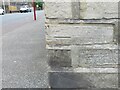
Ordnance Survey Cut Mark
This mark can be found on the wall of a former Sunday School on Shay Lane, Holmfield.
The recorded details give a height of 194.5996 metres above sea level.
For more detail see : https://www.bench-marks.org.uk/bm170009
Image: © Peter Wood
Taken: 23 Aug 2023
0.03 miles
9
Kingdom Hall - Jehovah's Witnesses - Shay Lane, Holmfield
Image: © Betty Longbottom
Taken: 25 Mar 2008
0.03 miles
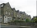
10
Livingstone Street North - Beechwood Road
Image: © Betty Longbottom
Taken: 24 Aug 2009
0.03 miles