IMAGES TAKEN NEAR TO
Lane Ends, HALIFAX, HX2 8TW
Introduction
This page details the photographs taken nearby to Lane Ends, HX2 8TW by members of the Geograph project.
The Geograph project started in 2005 with the aim of publishing, organising and preserving representative images for every square kilometre of Great Britain, Ireland and the Isle of Man.

There are currently over 7.5m images from over14,400 individuals and you can help contribute to the project by visiting https://www.geograph.org.uk
Image Map
Images are licensed for reuse under creativecommons.org/licenses/by-sa/2.0
Notes
- Clicking on the map will re-center to the selected point.
- The higher the marker number, the further away the image location is from the centre of the postcode.
Image Listing (66 Images Found)
Images are licensed for reuse under creativecommons.org/licenses/by-sa/2.0
Image
Details
Distance
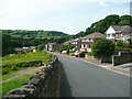
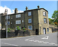
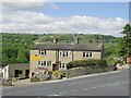
1
Boy Lane, Wheatley, Halifax
No through road that runs down to Hebble Brook at Ridings Bridge
Image: © Chris Heaton
Taken: 14 Jun 2020
0.04 miles
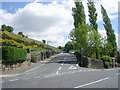
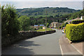
7
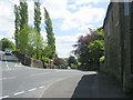
Wheatley Road - viewed from end of Denfield Lane
Image: © Betty Longbottom
Taken: 28 May 2010
0.06 miles
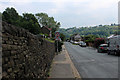
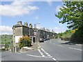
8
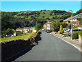
Boy Lane, Halifax
Boy Lane, on the outskirts of Halifax.
This view looks westwards, towards a viaduct which once carried a railway line. The railway closed completely in 1960.
Image: © Malc McDonald
Taken: 29 Aug 2016
0.06 miles