IMAGES TAKEN NEAR TO
Green Hill, HALIFAX, HX2 7SF
Introduction
This page details the photographs taken nearby to Green Hill, HX2 7SF by members of the Geograph project.
The Geograph project started in 2005 with the aim of publishing, organising and preserving representative images for every square kilometre of Great Britain, Ireland and the Isle of Man.

There are currently over 7.5m images from over14,400 individuals and you can help contribute to the project by visiting https://www.geograph.org.uk
Image Map (71 Images)


Getting Data...Please wait
Leaflet Map data © OpenStreetMap
Images are licensed for reuse under creativecommons.org/licenses/by-sa/2.0
Notes
- Clicking on the map will re-center to the selected point.
- The higher the marker number, the further away the image location is from the centre of the postcode.
Image Listing (71 Images Found)
Images are licensed for reuse under creativecommons.org/licenses/by-sa/2.0
Image
Details
Distance
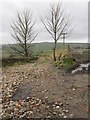
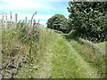
4
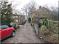
Green Hill - looking towards Winterburn Lane
Image: © Betty Longbottom
Taken: 26 Jan 2015
0.02 miles
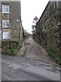
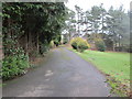
5
Paradise Lane - viewed from Dark Lane
Image: © Betty Longbottom
Taken: 26 Jan 2015
0.04 miles
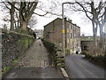
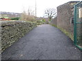
6

Water Hill Lane
Lane descending through the small community of Hoyle Green
Image: © Chris Heaton
Taken: 4 Mar 2023
0.05 miles
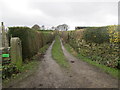
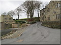
9
Pigman Lane approaching Winterburn Lane, Warley
This is part of Halifax FP634.
Image: © Humphrey Bolton
Taken: 3 Jul 2017
0.06 miles