IMAGES TAKEN NEAR TO
Pye Nest Road, HALIFAX, HX2 7HF
Introduction
This page details the photographs taken nearby to Pye Nest Road, HX2 7HF by members of the Geograph project.
The Geograph project started in 2005 with the aim of publishing, organising and preserving representative images for every square kilometre of Great Britain, Ireland and the Isle of Man.

There are currently over 7.5m images from over14,400 individuals and you can help contribute to the project by visiting https://www.geograph.org.uk
Image Map (Loading...)


Getting Data...Please wait
Leaflet Map data © OpenStreetMap
Images are licensed for reuse under creativecommons.org/licenses/by-sa/2.0
Notes
- Clicking on the map will re-center to the selected point.
- The higher the marker number, the further away the image location is from the centre of the postcode.
Image Listing (127 Images Found)
Images are licensed for reuse under creativecommons.org/licenses/by-sa/2.0
Image
Details
Distance
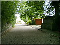
4
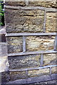
Benchmark on #21 Pye Nest Road
Ordnance Survey cut mark benchmark levelled at 159.069m above Newlyn Datum
Image: © Roger Templeman
Taken: 29 May 2018
0.03 miles
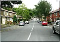
5
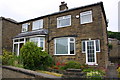
Nos. 19 and 21 Pye Nest Road
There is an OS benchmark Image on the side of the right hand house at its front corner
Image: © Roger Templeman
Taken: 29 May 2018
0.04 miles
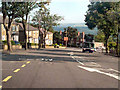
6
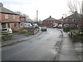
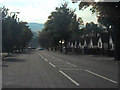
Crestfield Drive - looking towards Pye Nest Road
Image: © Betty Longbottom
Taken: 6 Jan 2014
0.04 miles
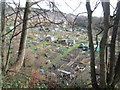
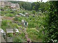
9
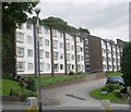
Hanover House Housing Association Flats - Pye Nest Road
Image: © Betty Longbottom
Taken: 4 Aug 2008
0.06 miles