
IMAGES TAKEN NEAR TO
Master Lane, HALIFAX, HX2 7AB
Introduction
This page details the photographs taken nearby to Master Lane, HX2 7AB by members of the Geograph project.
The Geograph project started in 2005 with the aim of publishing, organising and preserving representative images for every square kilometre of Great Britain, Ireland and the Isle of Man.

There are currently over 7.5m images from over14,400 individuals and you can help contribute to the project by visiting https://www.geograph.org.uk
Image Map
Images are licensed for reuse under creativecommons.org/licenses/by-sa/2.0
Notes
- Clicking on the map will re-center to the selected point.
- The higher the marker number, the further away the image location is from the centre of the postcode.
Image Listing (177 Images Found)
Images are licensed for reuse under creativecommons.org/licenses/by-sa/2.0
Image
Details
Distance
1
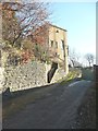
Tall building near to Washer Lane Dyeworks
I think that this was an office building. It is on the 1907 map but not on the 1894 map. The cobbled road is an alternative access to the works.
Image: © Humphrey Bolton
Taken: 11 Dec 2012
0.01 miles
2
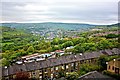
Terraced Houses, Scar Bottom Road
Terraced housing in the foreground with a view towards Sowerby Bridge and Calderdale in the background. Taken from road just below Wainhouse Tower.
Image: © Paul Buckingham
Taken: 19 May 2012
0.02 miles
3
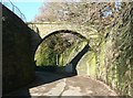
Aqueduct over the road to Washer Lane Dyeworks
This carried spring water to feed a millpond, now filled in.
Image: © Humphrey Bolton
Taken: 11 Dec 2012
0.04 miles
4
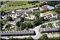
Washer Lane Industrial Estate from Wainhouse Tower
Image: © Colin Park
Taken: 21 Jun 1998
0.05 miles
5
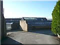
Part of Washer Lane Dyeworks
This was established by Robert Wainhouse in the early 19C. It is now divided into industrial units.
Image: © Humphrey Bolton
Taken: 11 Dec 2012
0.05 miles
6
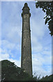
Wainhouse Tower, Halifax
Probably the most ornate factory chimney in the land, the Wainhouse Tower is certainly the tallest folly. A prominent local landmark. Check out: http://www.heritage.co.uk/follies/ffwy09.html
Image: © Ian M
Taken: 6 Aug 2005
0.05 miles
7
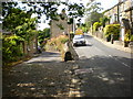
Master Lane to the left Scarr Bottom Road to the right
Image: © Alexander P Kapp
Taken: 14 Jul 2009
0.05 miles
8
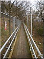
Temporary bridge on the footpath below Wainhouse Tower
Image: © Alexander P Kapp
Taken: 16 Dec 2008
0.05 miles
9
Wainhouse Tower, South side of base
What is behind the blocked off arch?
Image: © Alexander P Kapp
Taken: 16 Dec 2008
0.06 miles
10

Wainhouse Tower, Cupola
http://www.worksofwainhouse.info/4.html
Image: © Alexander P Kapp
Taken: 16 Dec 2008
0.07 miles