1
Burnley Road (A646), Brearley
Image: © David Dixon
Taken: 3 Sep 2010
0.01 miles
2
Ordnance Survey Flush Bracket G2153
This can be found on a roadside wall in Burnley Road near Woodleigh.
For more detail see : http://www.bench-marks.org.uk/bm14172
Image: © Peter Wood
Taken: 30 Jan 2013
0.01 miles
3
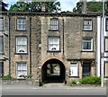
Archway to the former Grove Brewery, Burnley Road
I had noticed for the first time that the name ‘Grove Brewery’ is inscribed on the arch.
Image: © Humphrey Bolton
Taken: 25 Jun 2012
0.02 miles
4
The Grove Inn, Burnley Road A646, Mytholmroyd
Three-storey houses to match the inn; which came first?
Image: © Humphrey Bolton
Taken: 16 Oct 2008
0.03 miles
5
The Grove Inn and Burnley Road, Brearley, Mytholmroyd
The inn is almost in line with the track into Brearley Wood, and made me wonder if the track is the pre-turnpike road, which would go past Brearley Hall. Next to the Inn, on the right, the 1905 1:2500 map shows a large square building captioned 'Grove Brewery'. The inn itself is not captioned.
Image: © Humphrey Bolton
Taken: 19 Feb 2009
0.03 miles
6
Brearley Upper Lock No 6, Rochdale Canal
Image: © Dr Neil Clifton
Taken: 28 May 1992
0.03 miles
7
Brearley Upper Lock No6, on the Rochdale Canal
Image: © Alexander P Kapp
Taken: 31 Oct 2008
0.03 miles
8
Old lane in Brearley Wood, Mytholmroyd
This is shown as a through lane on the 1850 six-inch map, passing Brearley Hall. It now only seems to lead to some footpaths through the wood, yet has two street lights (one behind the camera). Maybe this lane was the route before a 'Brearley Hall bypass' was constructed as part of the turnpike road in c.1760.
Image: © Humphrey Bolton
Taken: 19 Feb 2009
0.04 miles
9
Stoney Springs Mill
Image: © JThomas
Taken: 18 May 2013
0.04 miles
10
The Grove Inn, Burnley Road
Image: © Alexander P Kapp
Taken: 26 Jan 2009
0.04 miles


