IMAGES TAKEN NEAR TO
Park Close, HALIFAX, HX2 0RG
Introduction
This page details the photographs taken nearby to Park Close, HX2 0RG by members of the Geograph project.
The Geograph project started in 2005 with the aim of publishing, organising and preserving representative images for every square kilometre of Great Britain, Ireland and the Isle of Man.

There are currently over 7.5m images from over14,400 individuals and you can help contribute to the project by visiting https://www.geograph.org.uk
Image Map (Loading...)


Getting Data...Please wait
Leaflet Map data © OpenStreetMap
Images are licensed for reuse under creativecommons.org/licenses/by-sa/2.0
Notes
- Clicking on the map will re-center to the selected point.
- The higher the marker number, the further away the image location is from the centre of the postcode.
Image Listing (51 Images Found)
Images are licensed for reuse under creativecommons.org/licenses/by-sa/2.0
Image
Details
Distance
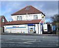
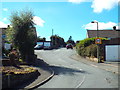
1
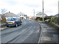
Park Close - looking towards Moor End Road
Image: © Betty Longbottom
Taken: 9 Feb 2015
0.02 miles
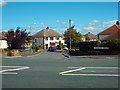
2
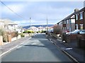
Park Fields - looking towards Moor End Road
Image: © Betty Longbottom
Taken: 9 Feb 2015
0.04 miles
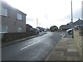
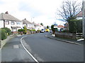
6
Woodlesford Crescent, Halifax
Woodlesford Crescent is a residential road on the outskirts of Halifax.
Image: © Malc McDonald
Taken: 29 Aug 2016
0.07 miles
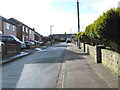
7
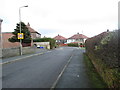
Woodlesford Crescent - Moor End Road
Image: © Betty Longbottom
Taken: 9 Feb 2015
0.08 miles
8
Woodlesford Crescent - Moor End Road
Image: © Betty Longbottom
Taken: 9 Feb 2015
0.09 miles
9
Broadley Road, Halifax
Broadley Road is a residential road on the outskirts of Halifax.
Image: © Malc McDonald
Taken: 29 Aug 2016
0.09 miles
10
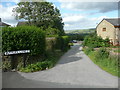
Buckley lane at Moor End Road, Halifax
This is Halifax Bridleway 484.
Image: © Humphrey Bolton
Taken: 25 Jun 2017
0.10 miles