IMAGES TAKEN NEAR TO
Highroad Well Lane, HALIFAX, HX2 0LQ
Introduction
This page details the photographs taken nearby to Highroad Well Lane, HX2 0LQ by members of the Geograph project.
The Geograph project started in 2005 with the aim of publishing, organising and preserving representative images for every square kilometre of Great Britain, Ireland and the Isle of Man.

There are currently over 7.5m images from over14,400 individuals and you can help contribute to the project by visiting https://www.geograph.org.uk
Image Map
Images are licensed for reuse under creativecommons.org/licenses/by-sa/2.0
Notes
- Clicking on the map will re-center to the selected point.
- The higher the marker number, the further away the image location is from the centre of the postcode.
Image Listing (56 Images Found)
Images are licensed for reuse under creativecommons.org/licenses/by-sa/2.0
Image
Details
Distance
1
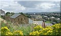
Grace Baptist Church - Roils Head Road
Image: © Betty Longbottom
Taken: 4 Aug 2008
0.01 miles
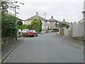
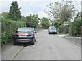
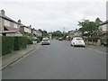
3
Highroad Well Lane - viewed from Mount Avenue
Image: © Betty Longbottom
Taken: 16 Jun 2014
0.05 miles
4

Grace Baptist Church, Roils Head Road, Halifax
A modern building on the site of a factory.
Image: © Humphrey Bolton
Taken: 23 Oct 2008
0.06 miles
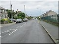
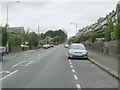
5
Roils Head Road - viewed from Newlands Road
Image: © Betty Longbottom
Taken: 16 Jun 2014
0.07 miles
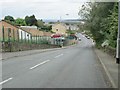
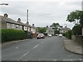
7
Roils Head Road - viewed from Well Royd Avenue
Image: © Betty Longbottom
Taken: 16 Jun 2014
0.08 miles
8
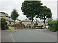
Golf Crescent - Highroad Well Lane
Image: © Betty Longbottom
Taken: 16 Jun 2014
0.08 miles
9
Gleanings Avenue - off Paddock Lane
Image: © Betty Longbottom
Taken: 16 Jun 2014
0.09 miles
10
Gleanings Avenue - looking towards Paddock Lane
Image: © Betty Longbottom
Taken: 16 Jun 2014
0.09 miles