IMAGES TAKEN NEAR TO
Coventry Street, HALIFAX, HX2 0BX
Introduction
This page details the photographs taken nearby to Coventry Street, HX2 0BX by members of the Geograph project.
The Geograph project started in 2005 with the aim of publishing, organising and preserving representative images for every square kilometre of Great Britain, Ireland and the Isle of Man.

There are currently over 7.5m images from over14,400 individuals and you can help contribute to the project by visiting https://www.geograph.org.uk
Image Map
Images are licensed for reuse under creativecommons.org/licenses/by-sa/2.0
Notes
- Clicking on the map will re-center to the selected point.
- The higher the marker number, the further away the image location is from the centre of the postcode.
Image Listing (90 Images Found)
Images are licensed for reuse under creativecommons.org/licenses/by-sa/2.0
Image
Details
Distance
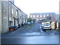
1
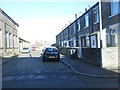
Coventry Street - Spring Hall Grove
Image: © Betty Longbottom
Taken: 20 Jan 2014
0.02 miles
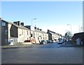
2
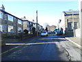
Spring Hall Grove - Spring Hall Lane
Image: © Betty Longbottom
Taken: 20 Jan 2014
0.02 miles
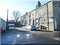
7
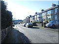
Spring Hall Gardens - Spring Hall Grove
Image: © Betty Longbottom
Taken: 20 Jan 2014
0.06 miles
9
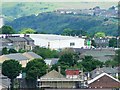
Asda, Thrum Hall, seen from Wainhouse Tower
Image: © Michael Steele
Taken: 21 Jun 2009
0.08 miles
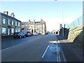
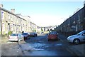
10
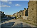
Beckenham Place, Halifax
A typical street of terraced houses.
Image: © Stephen Craven
Taken: 12 Nov 2022
0.09 miles