IMAGES TAKEN NEAR TO
Norfolk Place, HALIFAX, HX1 3JY
Introduction
This page details the photographs taken nearby to Norfolk Place, HX1 3JY by members of the Geograph project.
The Geograph project started in 2005 with the aim of publishing, organising and preserving representative images for every square kilometre of Great Britain, Ireland and the Isle of Man.

There are currently over 7.5m images from over14,400 individuals and you can help contribute to the project by visiting https://www.geograph.org.uk
Image Map
Images are licensed for reuse under creativecommons.org/licenses/by-sa/2.0
Notes
- Clicking on the map will re-center to the selected point.
- The higher the marker number, the further away the image location is from the centre of the postcode.
Image Listing (148 Images Found)
Images are licensed for reuse under creativecommons.org/licenses/by-sa/2.0
Image
Details
Distance
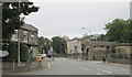
2
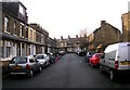
Terrace houses, King Cross Road
These are not on the 1905 1:2500 map.
Image: © Humphrey Bolton
Taken: 13 Jan 2014
0.03 miles
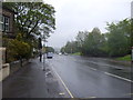
3
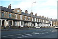
King Cross Street - viewed from Parkinson Lane
Image: © Betty Longbottom
Taken: 7 Oct 2013
0.04 miles


9
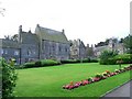
Joseph Crossley Almshouses
Top left is the Chapel where the people are expected to attend each Thursday.
Image: © Stanley Walker
Taken: 22 Aug 2008
0.07 miles