IMAGES TAKEN NEAR TO
Rothwell Road, HALIFAX, HX1 2HA
Introduction
This page details the photographs taken nearby to Rothwell Road, HX1 2HA by members of the Geograph project.
The Geograph project started in 2005 with the aim of publishing, organising and preserving representative images for every square kilometre of Great Britain, Ireland and the Isle of Man.

There are currently over 7.5m images from over14,400 individuals and you can help contribute to the project by visiting https://www.geograph.org.uk
Image Map
Images are licensed for reuse under creativecommons.org/licenses/by-sa/2.0
Notes
- Clicking on the map will re-center to the selected point.
- The higher the marker number, the further away the image location is from the centre of the postcode.
Image Listing (141 Images Found)
Images are licensed for reuse under creativecommons.org/licenses/by-sa/2.0
Image
Details
Distance
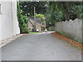
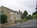
3
Rothwell Road - viewed from Rothwell Drive
Image: © Betty Longbottom
Taken: 7 Oct 2013
0.04 miles
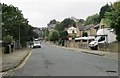
6
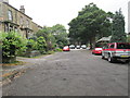
Rothwell Mount - looking towards Rothwell Road
Image: © Betty Longbottom
Taken: 7 Oct 2013
0.06 miles
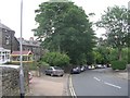
8
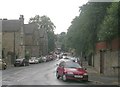
Savile Park Road - viewed from Arden Road
Image: © Betty Longbottom
Taken: 6 Jul 2009
0.08 miles
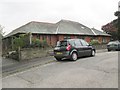
9
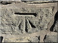
OS Cut Benchmark, Savile Park Road
This can be found on a wall close to the junction with Rothwell Road. Details at https://www.bench-marks.org.uk/bm83355
Image: © Stephen Armstrong
Taken: 24 Sep 2018
0.08 miles
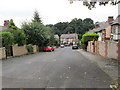
10
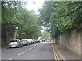
Haugh Shaw Road - viewed from Arden Road
Image: © Betty Longbottom
Taken: 6 Jul 2009
0.09 miles