
IMAGES TAKEN NEAR TO
Western Gailes Way, HULL, HU8 9EQ
Introduction
This page details the photographs taken nearby to Western Gailes Way, HU8 9EQ by members of the Geograph project.
The Geograph project started in 2005 with the aim of publishing, organising and preserving representative images for every square kilometre of Great Britain, Ireland and the Isle of Man.

There are currently over 7.5m images from over14,400 individuals and you can help contribute to the project by visiting https://www.geograph.org.uk
Image Map
Images are licensed for reuse under creativecommons.org/licenses/by-sa/2.0
Notes
- Clicking on the map will re-center to the selected point.
- The higher the marker number, the further away the image location is from the centre of the postcode.
Image Listing (186 Images Found)
Images are licensed for reuse under creativecommons.org/licenses/by-sa/2.0
Image
Details
Distance
1

Risholme Carr, Sutton on Hull, Yorkshire
Much of the land has been redeveloped for housing; grazing no longer takes place. Areas, including that depicted, have been set aside for amenity purposes.
Image: © Bernard Sharp
Taken: 25 Nov 1984
0.04 miles
2

Western Gailes Way, Kingston upon Hull
Dwellings in Western Gailes Way after a snowfall. Viewed from open land that was previously used for arable farming in the parish of Sutton on Hull.
Image: © Bernard Sharp
Taken: 20 Jan 2013
0.04 miles
3
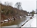
Holderness Drain, Kingston upon Hull
Looking upstream from the bridge on Saltshouse Road.
Image: © Bernard Sharp
Taken: 20 Jan 2013
0.07 miles
4

Risholme Carr, Kingston upon Hull
Risholme Carr was originally pasture attached to the parish of Sutton on Hull. Today, it is open land, for the benefit of the public. On the edge of the woodland, looking across the grassland towards dwellings in Western Gailes Way.
Image: © Bernard Sharp
Taken: 1 Jun 2023
0.07 miles
5
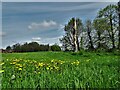
Risholme Carr, Kingston upon Hull
Risholme Carr was originally pasture attached to the parish of Sutton on Hull. Today, it is open land, for the benefit of the public. The trees, right, once provided shade for grazing cattle; some of the former are dead and saplings have been planted to replace them. Dandelions proliferate.
Image: © Bernard Sharp
Taken: 3 May 2023
0.08 miles
6
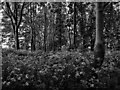
Risholme Carr, Kingston upon Hull
Risholme Carr was originally pasture attached to the parish of Sutton on Hull. Today, it is open land, for the benefit of the public. In the heart of the woodland, with ground cover largely comprised of umbellifers.
Image: © Bernard Sharp
Taken: 1 Jun 2023
0.08 miles
8
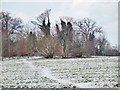
Eastfield, Kingston upon Hull
Eastfield is one of the three former arable fields in the parish of Sutton on Hull. Although much of the land has been redeveloped for housing, areas have been set aside for amenity purposes. Depicted is a lightly snow-covered wooded area to the north-west.
Image: © Bernard Sharp
Taken: 22 Dec 2010
0.08 miles
9
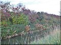
Holderness Drain, Kingston upon Hull
Autumn colour on the west bank of the Drain.
Image: © Bernard Sharp
Taken: 9 Nov 2013
0.09 miles
10

Holderness Drain, Kingston upon Hull
Reflection of reeds in the Drain.
Image: © Bernard Sharp
Taken: Unknown
0.09 miles