
IMAGES TAKEN NEAR TO
Alder Hey Drive, HULL, HU8 0FF
Introduction
This page details the photographs taken nearby to Alder Hey Drive, HU8 0FF by members of the Geograph project.
The Geograph project started in 2005 with the aim of publishing, organising and preserving representative images for every square kilometre of Great Britain, Ireland and the Isle of Man.

There are currently over 7.5m images from over14,400 individuals and you can help contribute to the project by visiting https://www.geograph.org.uk
Image Map
Images are licensed for reuse under creativecommons.org/licenses/by-sa/2.0
Notes
- Clicking on the map will re-center to the selected point.
- The higher the marker number, the further away the image location is from the centre of the postcode.
Image Listing (309 Images Found)
Images are licensed for reuse under creativecommons.org/licenses/by-sa/2.0
Image
Details
Distance
1

Middlesex Road, Kingston upon Hull
Looking south from Saltshouse Road towards Bellfield Avenue. The hawthorn, left, originally delineated a boundary in the former East Field.
Image: © Bernard Sharp
Taken: 27 Nov 2013
0.01 miles
2
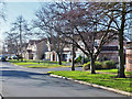
St Bartholomew's Way, Kingston upon Hull
Planning approval granted 2000 for the erection of 104 houses, access roads and play area on the site of Tilworth Grange. The roads are named after hospitals. Depicted is St Bartholomew's Way, with junction at Alder Hey Drive.
Image: © Bernard Sharp
Taken: 13 Feb 2014
0.02 miles
3
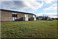
Empty houses on Ealing Close
Ings Road Estate, Hull.
Image: © Ian S
Taken: 10 Feb 2016
0.04 miles
4

Finchley Close, Kingston upon Hull
At The Leeway, Phase 2, 68 dwellings are being built on land at the former Hammersmith Close and Finchley Close, to the south of Saltshouse Road and west of Middlesex Road. The development is being undertaken by Compendium Living, a company set up and jointly owned by Lovell and Riverside. With the houses having been built, the road remains to be surfaced.
Image: © Bernard Sharp
Taken: 19 Apr 2019
0.04 miles
5

Middlesex Road, Kingston upon Hull
Land to the west of Middlesex Road and north of Bellfield Avenue is being redeveloped for the construction of 101 dwellings and a children's home at The Leeway, Phase 4. In the foreground, fronting Middlesex Road, the foundations of a new house. In the background, new-build dwellings and Bayswater Court, Bellfield Avenue.
Image: © Bernard Sharp
Taken: 25 Mar 2023
0.05 miles
6

Middlesex Road, Kingston upon Hull: Highway Improvement 2025
It is day 135 of the improvement works. Plant is in use for the laying of tarmac on Middlesex Road.
Image: © Bernard Sharp
Taken: 5 Aug 2025
0.05 miles
7
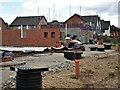
Middlesex Road, Kingston upon Hull
Land to the west of Middlesex Road and north of Bellfield Avenue is being redeveloped for the construction of dwellings at The Leeway, phase 3. The first dwellings under this phase are being built towards the north-east of the site.
Image: © Bernard Sharp
Taken: 30 Jul 2023
0.05 miles
8

Middlesex Road, Kingston upon Hull
At The Leeway, Phase 2, 68 dwellings are being built on land at the former Hammersmith Close and Finchley Close, to the south of Saltshouse Road and west of Middlesex Road. The development is being undertaken by Compendium Living, a company set up and jointly owned by Lovell and Riverside.
Image: © Bernard Sharp
Taken: 9 Feb 2021
0.06 miles
9

St Bartholomew's Way, Kingston upon Hull
A modern housing estate, built on the grounds of the former Tilworth Grange. This magnificent copper beech has, fortunately, been retained.
Image: © Bernard Sharp
Taken: 27 Nov 2013
0.06 miles
10

St Bartholomew's Way, Kingston upon Hull
Planning approval granted 2000 for the erection of 104 houses, access roads and play area on the site of Tilworth Grange. The roads are named after hospitals. Depicted are houses at the junction with Saltshouse Road. This fine tree stood in the grounds of the former Grange.
Image: © Bernard Sharp
Taken: Unknown
0.07 miles