IMAGES TAKEN NEAR TO
Cotterdale, HULL, HU7 4AB
Introduction
This page details the photographs taken nearby to Cotterdale, HU7 4AB by members of the Geograph project.
The Geograph project started in 2005 with the aim of publishing, organising and preserving representative images for every square kilometre of Great Britain, Ireland and the Isle of Man.

There are currently over 7.5m images from over14,400 individuals and you can help contribute to the project by visiting https://www.geograph.org.uk
Image Map
Images are licensed for reuse under creativecommons.org/licenses/by-sa/2.0
Notes
- Clicking on the map will re-center to the selected point.
- The higher the marker number, the further away the image location is from the centre of the postcode.
Image Listing (85 Images Found)
Images are licensed for reuse under creativecommons.org/licenses/by-sa/2.0
Image
Details
Distance
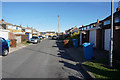
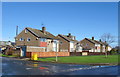
3
Path leading to Littondale, Sutton Park, Hull
Image: © Ian S
Taken: 24 Oct 2018
0.06 miles
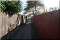
5
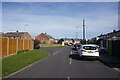
Coverdale off Niddledale, Hull
https://www.geograph.org.uk/photo/6807174
Image: © Ian S
Taken: 29 Mar 2021
0.08 miles


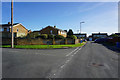
9
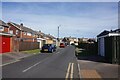
Calderdale off Niddledale, Hull
https://www.geograph.org.uk/photo/6807169
Image: © Ian S
Taken: 29 Mar 2021
0.10 miles
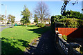
10
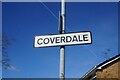
Coverdale off Niddledale, Hull
https://www.geograph.org.uk/photo/6807173
Image: © Ian S
Taken: 29 Mar 2021
0.11 miles