IMAGES TAKEN NEAR TO
Crinan Drive, HULL, HU6 7XD
Introduction
This page details the photographs taken nearby to Crinan Drive, HU6 7XD by members of the Geograph project.
The Geograph project started in 2005 with the aim of publishing, organising and preserving representative images for every square kilometre of Great Britain, Ireland and the Isle of Man.

There are currently over 7.5m images from over14,400 individuals and you can help contribute to the project by visiting https://www.geograph.org.uk
Image Map
Images are licensed for reuse under creativecommons.org/licenses/by-sa/2.0
Notes
- Clicking on the map will re-center to the selected point.
- The higher the marker number, the further away the image location is from the centre of the postcode.
Image Listing (85 Images Found)
Images are licensed for reuse under creativecommons.org/licenses/by-sa/2.0
Image
Details
Distance
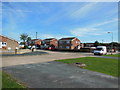
4

Beverley and Barmston Drain looking North
Not far now to the countryside
Image: © Martin Dawes
Taken: 11 Apr 2012
0.06 miles
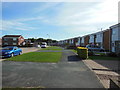
7

Jenthorpe off Thorpepark Road, Hull
https://www.geograph.org.uk/photo/6859138
Image: © Ian S
Taken: 17 May 2021
0.07 miles
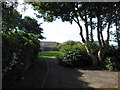
10

Kinthorpe off Thorpepark Road, Hull
https://www.geograph.org.uk/photo/6859155
Image: © Ian S
Taken: 17 May 2021
0.09 miles