
IMAGES TAKEN NEAR TO
Anlaby Road, HULL, HU3 6TA
Introduction
This page details the photographs taken nearby to Anlaby Road, HU3 6TA by members of the Geograph project.
The Geograph project started in 2005 with the aim of publishing, organising and preserving representative images for every square kilometre of Great Britain, Ireland and the Isle of Man.

There are currently over 7.5m images from over14,400 individuals and you can help contribute to the project by visiting https://www.geograph.org.uk
Image Map
Images are licensed for reuse under creativecommons.org/licenses/by-sa/2.0
Notes
- Clicking on the map will re-center to the selected point.
- The higher the marker number, the further away the image location is from the centre of the postcode.
Image Listing (234 Images Found)
Images are licensed for reuse under creativecommons.org/licenses/by-sa/2.0
Image
Details
Distance
1

The Silver Cod, Hull
Pub on the north side of Anlaby Road which seems to have survived the vicissitudes of the changing licensed trade, and Covid etc, maybe partly because it is equidistant between Hull City FC's old ground and its newer one, thus not losing out on match day business due to the move.
Image: © Paul Harrop
Taken: 10 Jun 2021
0.01 miles
2
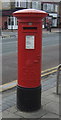
George V postbox on Anlaby Road, Hull
Image: © JThomas
Taken: 18 Feb 2018
0.01 miles

4

Shops on Anlaby Road, Hull
Showing position of Postbox No. HU3 22.
See Image] for postbox.
Image: © JThomas
Taken: 18 Feb 2018
0.01 miles
5

Anlaby Road, Hull
Looking east-northeast towards the Carlton Theatre from just west of Stirling Street. Designed by Blackmore and Sykes and built by Greenwood and Sons, the Carlton opened on September 9th 1928 showing the silent film "Lonesome Ladies". It was a lavishly decorated cinema with a Fitton and Haley organ which was later removed to the more central Cecil Theatre, destroyed by bombing during World War 2. The Carlton closed in April 1967 and was used as a bingo hall until fairly recently. The building is now disused.
Image: © Paul Glazzard
Taken: 21 Feb 2009
0.02 miles

7

Parkfield Drive, Hull
Suburban terraced housing off the north side of Anlaby Road, built in 1928 on the site of the old Hull Racecourse. Race meetings were held here from at least as far back as 1754 and continued into the 19th century. The Royal Agricultural Show was held here in 1873 and 1899, and the Yorkshire Show in 1904. Information taken from 'The Anlaby Road' by Paul Gibson, an online version of which can be found here: http://www.anlabyroad.com/history/anlabyroadhist01.html
Image: © Paul Glazzard
Taken: 11 May 2009
0.02 miles
8

The Malt Shovel, Hull
An Enterprise inn on Anlaby Road.
Image: © JThomas
Taken: 18 Feb 2018
0.02 miles
9
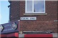
Stirling Street, Hull
https://www.geograph.org.uk/photo/6795342
Image: © Ian S
Taken: 27 Mar 2021
0.03 miles
10
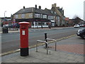
Anlaby Road, Hull
Showing position of Postbox No. HU3 22.
See Image] for postbox.
Image: © JThomas
Taken: 18 Feb 2018
0.03 miles