
IMAGES TAKEN NEAR TO
Brindle Road, HULL, HU3 5BY
Introduction
This page details the photographs taken nearby to Brindle Road, HU3 5BY by members of the Geograph project.
The Geograph project started in 2005 with the aim of publishing, organising and preserving representative images for every square kilometre of Great Britain, Ireland and the Isle of Man.

There are currently over 7.5m images from over14,400 individuals and you can help contribute to the project by visiting https://www.geograph.org.uk
Image Map
Images are licensed for reuse under creativecommons.org/licenses/by-sa/2.0
Notes
- Clicking on the map will re-center to the selected point.
- The higher the marker number, the further away the image location is from the centre of the postcode.
Image Listing (217 Images Found)
Images are licensed for reuse under creativecommons.org/licenses/by-sa/2.0
Image
Details
Distance
1
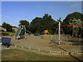
Children's playground
On Newington Street, Hull.
Image: © Ian S
Taken: 26 Jul 2010
0.04 miles
4

51 - 61 Haltemprice Street, Hull
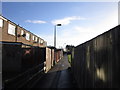
The backs of houses at the western end of Haltemprice Street, looking northwest from Athol Street. Many of the old terraced houses in this area have already been bulldozed and these have been earmarked for demolition between now and 2011, although there's still someone living in No. 61 (the one with the odd extension at the far end).
Image: © Paul Glazzard
Taken: 21 Feb 2009
0.06 miles
5
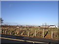
From a train - new building in progress
From a passing excursion train, heading for the docks.
Image: © Nigel Thompson
Taken: 13 Jul 2014
0.07 miles
7
Newington Street, Hull
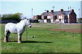
Grassed-over waste ground off the north side of Newington Street, looking northwest across the site of Calthorpe Gardens, Eldon Grove and Athol Street where the old terraced houses were recently demolished as part of the city council's Newington & St Andrew's regeneration scheme. On the right are Nos. 51-61 Haltemprice Street which are also due for demolition between now and 2011, although there's still someone living at No.61. Behind the houses are the floodlights at Boothferry Park football stadium. http://www.geograph.org.uk/photo/308949
Image: © Paul Glazzard
Taken: 5 Apr 2009
0.07 miles

10
Newington Street, Hull
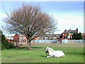
Grassed-over waste ground off the north side of Newington Street, looking northeast across the site of Dorothy Grove, Minnie's Grove and Gilbert Avenue where the old terraced houses were recently demolished as part of the city council's Newington & St Andrew's regeneration scheme. Some pictures of Minnie's Grove being demolished can be seen here: http://www.geograph.org.uk/photo/1209433 & http://www.geograph.org.uk/photo/1207454
Image: © Paul Glazzard
Taken: 5 Apr 2009
0.09 miles