
IMAGES TAKEN NEAR TO
Wincolmlee, HULL, HU2 0QL
Introduction
This page details the photographs taken nearby to Wincolmlee, HU2 0QL by members of the Geograph project.
The Geograph project started in 2005 with the aim of publishing, organising and preserving representative images for every square kilometre of Great Britain, Ireland and the Isle of Man.

There are currently over 7.5m images from over14,400 individuals and you can help contribute to the project by visiting https://www.geograph.org.uk
Image Map
Images are licensed for reuse under creativecommons.org/licenses/by-sa/2.0
Notes
- Clicking on the map will re-center to the selected point.
- The higher the marker number, the further away the image location is from the centre of the postcode.
Image Listing (330 Images Found)
Images are licensed for reuse under creativecommons.org/licenses/by-sa/2.0
Image
Details
Distance
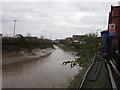
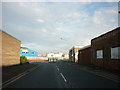
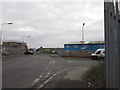
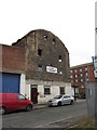
5
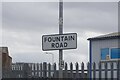
Fountain Road, Hull
https://www.geograph.org.uk/photo/6774851
Image: © Ian S
Taken: 5 Mar 2021
0.05 miles
6
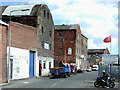
Lion Wharf Mills, Wincolmlee
Warehouses and former mill buildings at 338-400 Wincolmlee, Hull, looking east-southeast across the northern end of Oxford Street. Most of the mills on Wincolmlee were built by the seed crushing industry who extracted vegetable oils from rape, linseed, cottonseed and soya beans for use in the manufacture of paint, soap, linoleum, margarine, cooking oil, animal cake and fertilizer. The buildings back straight on to the west bank of the River Hull. The area was heavily bombed during World War Two and the battered buildings have had a variety of uses since then. The former Boothferry Reclaimed Pine warehouse at No.388 (right of centre) was being used as an illegal drugs factory in June 2007, when a police raid on the property recovered cannabis plants with an estimated street value of over £1 million. The building was damaged by an arson attack in August 2008.
Image: © Paul Glazzard
Taken: 1 Apr 2009
0.05 miles
8
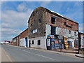
Wincolmlee, Kingston upon Hull
No.388 Wincolmlee, Lion Mills, utilised for seed crushing, now Lion Wharf, occupied by G.K. Auto Services.
Image: © Bernard Sharp
Taken: 30 Jun 2013
0.05 miles
10

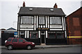
The Kingston
The Kingston pub on Cumberland Street in Hull.
Image: © Stephen Meara-Blount
Taken: 26 Apr 2012
0.05 miles