IMAGES TAKEN NEAR TO
Mill Lane, WITHERNSEA, HU19 2SE
Introduction
This page details the photographs taken nearby to Mill Lane, HU19 2SE by members of the Geograph project.
The Geograph project started in 2005 with the aim of publishing, organising and preserving representative images for every square kilometre of Great Britain, Ireland and the Isle of Man.

There are currently over 7.5m images from over14,400 individuals and you can help contribute to the project by visiting https://www.geograph.org.uk
Image Map
Images are licensed for reuse under creativecommons.org/licenses/by-sa/2.0
Notes
- Clicking on the map will re-center to the selected point.
- The higher the marker number, the further away the image location is from the centre of the postcode.
Image Listing (28 Images Found)
Images are licensed for reuse under creativecommons.org/licenses/by-sa/2.0
Image
Details
Distance
6
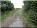
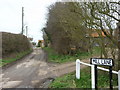
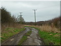
South Leys Road track from fields into Hollym
It is metaled as it nears the village
Image: © Martin Dawes
Taken: 14 Sep 2022
0.11 miles
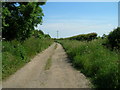
7
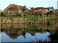
Manor Farm, Hollym
Looking north-northeast across the fishing pond from South Leys Road.
Image: © Paul Glazzard
Taken: 16 Dec 2006
0.11 miles

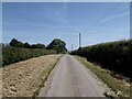
9
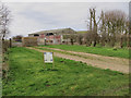
Farm at Hollym
Seen from South Leys Road, some of the buildings at Eastfield Farm
Image: © Paul Harrop
Taken: 27 Feb 2017
0.12 miles
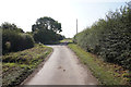
10
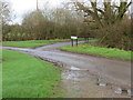
Road junction at Eastfield Farm
Looking north-westward.
Image: © Peter Wood
Taken: 28 Dec 2015
0.13 miles