
IMAGES TAKEN NEAR TO
Holmpton, WITHERNSEA, HU19 2QU
Introduction
This page details the photographs taken nearby to HU19 2QU by members of the Geograph project.
The Geograph project started in 2005 with the aim of publishing, organising and preserving representative images for every square kilometre of Great Britain, Ireland and the Isle of Man.

There are currently over 7.5m images from over14,400 individuals and you can help contribute to the project by visiting https://www.geograph.org.uk
Image Map
Images are licensed for reuse under creativecommons.org/licenses/by-sa/2.0
Notes
- Clicking on the map will re-center to the selected point.
- The higher the marker number, the further away the image location is from the centre of the postcode.
Image Listing (31 Images Found)
Images are licensed for reuse under creativecommons.org/licenses/by-sa/2.0
Image
Details
Distance
2
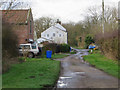
School Lane, Holmpton
Cul-de-sac lane to the east of the village, looking towards the main part of the settlement
Image: © Paul Harrop
Taken: 27 Feb 2017
0.02 miles
3

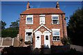
Coastguard Cottages, Holmpton
Built in 1877 on the corner of School Lane and Taylor Lane, the cottages were once home to the Holmpton coastguards and their families.
Image: © Paul Glazzard
Taken: 13 Dec 2006
0.03 miles
4
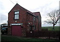
Rocket House, Holmpton
East of the junction of School Lane and Taylor Lane at Holmpton on the North Sea coast, the house is named after (and was presumably built for) the Rocket Brigade which once operated here.
The brigades used rockets to fire a line to a stricken ship and this line was then used to pull in a heavier rope allowing the crew to escape to shore. The apparatus was invented by a Cornishman, Henry Trengrouse, inspired by a firework display celebrating the birthday of King George III. Trengrouse dedicated his life to inventing lifesaving equipment after witnessing the loss of the frigate HMS Anson off the Cornish coast in 1807.
Image: © Paul Glazzard
Taken: 26 Jan 2007
0.05 miles

6
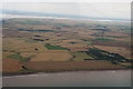
Holmpton, land to the south and view to Sunk Island: aerial 2015
Behind the boulder clay cliffs of Holderness's eroding coastline.
Image: © Chris
Taken: 23 Jul 2015
0.09 miles
7
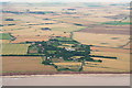
Holmpton and the boulder clay cliffs of Holderness's eroding coastline: aerial 2015
Image: © Chris
Taken: 23 Jul 2015
0.09 miles
8

Former Holmpton Church School
On School Lane, rebuilt in 1862. Now the village hall.
Image: © Ian S
Taken: 30 Aug 2018
0.10 miles

10
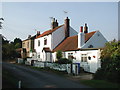
Taylor's Lane, Holmpton
Looking north-northwest from Springfield towards Ainlee, Acacia Cottage, Cosey Cottage and The Nest.
Image: © Paul Glazzard
Taken: 26 Sep 2008
0.11 miles