
IMAGES TAKEN NEAR TO
Elveley Drive, HULL, HU10 7RT
Introduction
This page details the photographs taken nearby to Elveley Drive, HU10 7RT by members of the Geograph project.
The Geograph project started in 2005 with the aim of publishing, organising and preserving representative images for every square kilometre of Great Britain, Ireland and the Isle of Man.

There are currently over 7.5m images from over14,400 individuals and you can help contribute to the project by visiting https://www.geograph.org.uk
Image Map
Images are licensed for reuse under creativecommons.org/licenses/by-sa/2.0
Notes
- Clicking on the map will re-center to the selected point.
- The higher the marker number, the further away the image location is from the centre of the postcode.
Image Listing (35 Images Found)
Images are licensed for reuse under creativecommons.org/licenses/by-sa/2.0
Image
Details
Distance
1
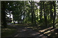
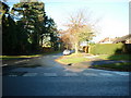
Passing through the woods to The Meadows in West Ella
Image: © Chris
Taken: 2 Oct 2016
0.03 miles
2
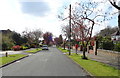
Elveley Drive, West Ella
Showing position of Postbox No. HU10 81.
See Image] for postbox.
Image: © JThomas
Taken: 9 Apr 2019
0.06 miles
3
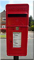
Close up, Elizabeth II postbox on Elveley Drive, West Ella
Postbox No. HU10 81.
See Image] for wider view.
Image: © JThomas
Taken: 9 Apr 2019
0.08 miles
4
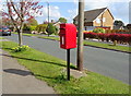
Elizabeth II postbox on Elveley Drive, West Ella
Image: © JThomas
Taken: 9 Apr 2019
0.08 miles

7
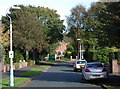
The Fairway, West Ella
Looking east-northeast from Elveley Drive. The Fairway is so called because some of the houses look out over Hull Golf Club to the east. Elveley Drive, once called Long Drive, used to be the carriage driveway from Riplingham Road to the gates of West Ella Hall before the area was developed for housing in the 1960s.
Image: © Paul Glazzard
Taken: 9 Oct 2008
0.12 miles
8

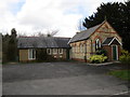
West Ella Methodist Church
Looking east-southeast from the junction of Manor Fields and Chapel Lane. The former Wesleyan Chapel was built in 1895 directly in front of an older one built in the early 1800s. The chapel was lit by oil lamps until 1921.
Image: © Paul Glazzard
Taken: 9 Oct 2008
0.13 miles
10
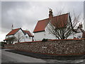
Houses, Manor Fields
The theme of white slightly gothick housing which was typical of pre-twentieth century West Ella has been continued on this small housing development.
Image: © Jonathan Thacker
Taken: 29 Mar 2015
0.16 miles