IMAGES TAKEN NEAR TO
Carr Lane, HULL, HU10 6JT
Introduction
This page details the photographs taken nearby to Carr Lane, HU10 6JT by members of the Geograph project.
The Geograph project started in 2005 with the aim of publishing, organising and preserving representative images for every square kilometre of Great Britain, Ireland and the Isle of Man.

There are currently over 7.5m images from over14,400 individuals and you can help contribute to the project by visiting https://www.geograph.org.uk
Image Map
Images are licensed for reuse under creativecommons.org/licenses/by-sa/2.0
Notes
- Clicking on the map will re-center to the selected point.
- The higher the marker number, the further away the image location is from the centre of the postcode.
Image Listing (34 Images Found)
Images are licensed for reuse under creativecommons.org/licenses/by-sa/2.0
Image
Details
Distance

4
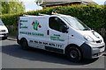
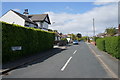
H B C Wheelie Bin Cleaning Van
On Hawthorne Avenue, Willerby.
Image: © Ian S
Taken: 16 May 2015
0.06 miles
7
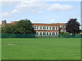
Willerby Carr Lane Primary School.
This school which is soon to be demolished was built in 1937. It will be replaced by a new building which is adjacent to this one.
Image: © Steve Buttle
Taken: 14 May 2008
0.12 miles
9

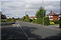
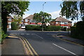
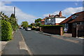
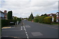
The junction of Overton Avenue and Hawthorne Avenue
Image: © Ian S
Taken: 16 May 2015
0.13 miles
