IMAGES TAKEN NEAR TO
Northbay Inn, ISLE OF BARRA, HS9 5XY
Introduction
This page details the photographs taken nearby to HS9 5XY by members of the Geograph project.
The Geograph project started in 2005 with the aim of publishing, organising and preserving representative images for every square kilometre of Great Britain, Ireland and the Isle of Man.

There are currently over 7.5m images from over14,400 individuals and you can help contribute to the project by visiting https://www.geograph.org.uk
Image Map
Images are licensed for reuse under creativecommons.org/licenses/by-sa/2.0
Notes
- Clicking on the map will re-center to the selected point.
- The higher the marker number, the further away the image location is from the centre of the postcode.
Image Listing (9 Images Found)
Images are licensed for reuse under creativecommons.org/licenses/by-sa/2.0
Image
Details
Distance
2
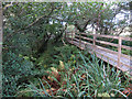
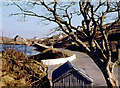
Walkway through woodland
A rare scene on the Outer Hebrides.
Image: © Hugh Venables
Taken: 19 Sep 2012
0.03 miles
3
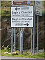
Northbay: signage on the A888
One of Britain's few truly circular roads, the A888 circuits the island of Barra. Here at Northbay, directions are given towards Castlebay in both directions - although no distances are given, there isn't much in it.
Image: © Chris Downer
Taken: 12 Aug 2012
0.18 miles
4
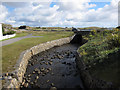
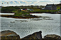
Abhainn nam Bhreac
Small stream being channelled into Bàgh Thiarabhagh.
Image: © Hugh Venables
Taken: 19 Sep 2012
0.18 miles
5
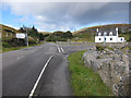
A888 loop road, Barra
Looking past the turning to the north of the island, including the ferry terminal at Aird Mhor and the airport.
Image: © Hugh Venables
Taken: 19 Sep 2012
0.18 miles