
IMAGES TAKEN NEAR TO
Kilpheder, ISLE OF SOUTH UIST, HS8 5TB
Introduction
This page details the photographs taken nearby to HS8 5TB by members of the Geograph project.
The Geograph project started in 2005 with the aim of publishing, organising and preserving representative images for every square kilometre of Great Britain, Ireland and the Isle of Man.

There are currently over 7.5m images from over14,400 individuals and you can help contribute to the project by visiting https://www.geograph.org.uk
Image Map
Images are licensed for reuse under creativecommons.org/licenses/by-sa/2.0
Notes
- Clicking on the map will re-center to the selected point.
- The higher the marker number, the further away the image location is from the centre of the postcode.
Image Listing (4 Images Found)
Images are licensed for reuse under creativecommons.org/licenses/by-sa/2.0
Image
Details
Distance
1
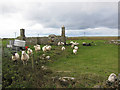
Abandoned house, Cille Pheadair
Now providing some shelter to a flock of sheep.
Image: © Hugh Venables
Taken: 22 Sep 2012
0.06 miles
2
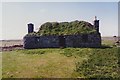
Ruined house, Cille Pheadair
In a poor state of repair, but still with most of its roof when photographed in 1995. Compare this with a similar view in 2010 [http://www.geograph.org.uk/photo/4079167].
Image: © Richard Sutcliffe
Taken: Unknown
0.06 miles
3
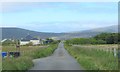
Minor road heading north east from Cille Pheadair
Crofting country between the machair and the bogs.
Image: © Gordon Hatton
Taken: 26 Jun 2019
0.10 miles
4
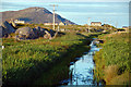
Drainage channel An Lige Mor
This obviously man-made channel drains Loch Thallan to the north into a bay at the top end of Loch Boisdale, which is dammed, keeping the sea out.
Image: © Greg Morss
Taken: 29 Jun 2007
0.25 miles