IMAGES TAKEN NEAR TO
South Locheynort, ISLE OF SOUTH UIST, HS8 5SL
Introduction
This page details the photographs taken nearby to HS8 5SL by members of the Geograph project.
The Geograph project started in 2005 with the aim of publishing, organising and preserving representative images for every square kilometre of Great Britain, Ireland and the Isle of Man.

There are currently over 7.5m images from over14,400 individuals and you can help contribute to the project by visiting https://www.geograph.org.uk
Image Map
Images are licensed for reuse under creativecommons.org/licenses/by-sa/2.0
Notes
- Clicking on the map will re-center to the selected point.
- The higher the marker number, the further away the image location is from the centre of the postcode.
Image Listing (8 Images Found)
Images are licensed for reuse under creativecommons.org/licenses/by-sa/2.0
Image
Details
Distance
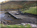
1
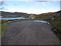
End of the road
Turning circle at the end of the road at Unasaraidh. No parking here.
Image: © Hugh Venables
Taken: 20 Sep 2012
0.03 miles
2
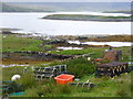
Creels at Unasaraidh
Fishing tools on the shore of the sea loch at South Loch Aineort.
http://www.visithebrides.com/islands/suist/
Image: © Colin Smith
Taken: 18 Jul 2011
0.06 miles
3
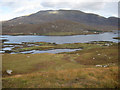
Loch Eynort
Looking down to Rubha Roinich.
Image: © Hugh Venables
Taken: 20 Sep 2012
0.10 miles
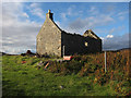
4
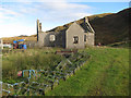
Abandoned house at Unasaraidh
Lobster creels also abandoned.
Image: © Hugh Venables
Taken: 20 Sep 2012
0.11 miles
5
Abandoned house at Unasaraidh
Near the jetty.
Image: © Hugh Venables
Taken: 20 Sep 2012
0.11 miles
6
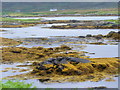
South Loch Aineort
Rocky shoreline with seaweed-covered skerries in the sea loch, Loch Aineort, at Unasaraidh.
Image: © Colin Smith
Taken: 18 Jul 2011
0.14 miles
7
Jetty at Unasaraidh
With a RUB (Rigid Uninflated Boat).
Image: © Hugh Venables
Taken: 20 Sep 2012
0.15 miles
8
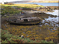
Ruined boat at Unasaraidh
Near the jetty.
Image: © Hugh Venables
Taken: 20 Sep 2012
0.16 miles