
IMAGES TAKEN NEAR TO
Rubha Ban, Eriskay, ISLE OF SOUTH UIST, HS8 5JJ
Introduction
This page details the photographs taken nearby to HS8 5JJ by members of the Geograph project.
The Geograph project started in 2005 with the aim of publishing, organising and preserving representative images for every square kilometre of Great Britain, Ireland and the Isle of Man.

There are currently over 7.5m images from over14,400 individuals and you can help contribute to the project by visiting https://www.geograph.org.uk
Image Map
Images are licensed for reuse under creativecommons.org/licenses/by-sa/2.0
Notes
- Clicking on the map will re-center to the selected point.
- The higher the marker number, the further away the image location is from the centre of the postcode.
Image Listing (53 Images Found)
Images are licensed for reuse under creativecommons.org/licenses/by-sa/2.0
Image
Details
Distance
1
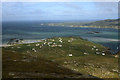
View to Rubha Ban and Sound of Eriskay from the summit of Ben Scrien (1998)
This photograph pre dates the causeway between Eriskay and South Uist.
Image: © Colin Park
Taken: 21 Aug 1998
0.05 miles
2
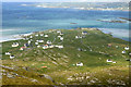
View to Rubha Ban and Sound of Eriskay from the summit of Ben Scrien (1998)
This photograph predates the linking causeway between Eriskay and South Uist.
Image: © Colin Park
Taken: 21 Aug 1998
0.05 miles
3
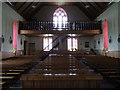
Inside the Church of St Michael of the Sea
Looking from the altar Image] towards the upper gallery of the Church of St Michael's of the Sea Image
Image: © Barbara Carr
Taken: 10 Jun 2009
0.06 miles
4
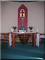
St Michael of the Sea - the altar
A unique altar in this island church. It combines part of a lifeboat lost from HMS Hermes in WW2.
Image: © Gordon Hatton
Taken: 22 Aug 2010
0.06 miles
5
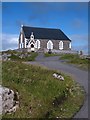
St Michael of the sea RC church
The church stands in a prominent position on a rocky hilltop overlooking the Eriskay causeway.
Image: © Gordon Hatton
Taken: 22 Aug 2010
0.06 miles
6
Eaglais Naomh Mhicheil
St Michael's Church, built in 1903.
Image: © John Allan
Taken: 5 Aug 2009
0.07 miles
7
St Michael's, Eirisgeigh
St. Michael's was built in 1903 by Father Allan MacDonald. The northern end of the church is shaped into the prow of a boat and illustrates its connection with the sea. The bell on display outside the church originally belonged to the German battleship, Derflinger, which was sunk at Scapa Flow.
Image: © Euan Nelson
Taken: 29 Mar 2012
0.07 miles
8
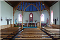
Eaglais Naomh Mhicheil
St Michael's Church was built in 1903. The altar is based on the prow of a lifeboat from HMS Hermes that was found washed up on the shore of South Uist.
Image: © John Allan
Taken: 5 Aug 2009
0.07 miles
10
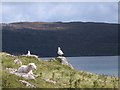
Just hanging around
Eriskay is a grand place to just hang around in the sun enjoying the view.
Image: © Gordon Hatton
Taken: 22 Aug 2010
0.07 miles