
IMAGES TAKEN NEAR TO
Baleloch, ISLE OF NORTH UIST, HS6 5DG
Introduction
This page details the photographs taken nearby to HS6 5DG by members of the Geograph project.
The Geograph project started in 2005 with the aim of publishing, organising and preserving representative images for every square kilometre of Great Britain, Ireland and the Isle of Man.

There are currently over 7.5m images from over14,400 individuals and you can help contribute to the project by visiting https://www.geograph.org.uk
Image Map
Images are licensed for reuse under creativecommons.org/licenses/by-sa/2.0
Notes
- Clicking on the map will re-center to the selected point.
- The higher the marker number, the further away the image location is from the centre of the postcode.
Image Listing (7 Images Found)
Images are licensed for reuse under creativecommons.org/licenses/by-sa/2.0
Image
Details
Distance
1
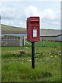
Baleloch: postbox № HS6 11
A small postbox serving a scattering of houses, emptied each morning except Sunday at half past eight.
Image: © Chris Downer
Taken: 14 Aug 2012
0.02 miles
2
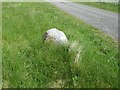
Old Milestone by the A865, Baleloch, above Loch Hosta, North Uist Parish
By the A865, in parish of North Uist (North Uist District), near Loch Hosta, opposite field gate, South West of postbox outside white house.
Surveyed
Milestone Society National ID: WI_NUCW08.
Image: © Milestone Society
Taken: Unknown
0.07 miles
3
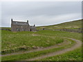
Farmhouse at Baile Loch
This newish house sits immediately north of Loch Hosta.
Image: © Richard Law
Taken: 16 Apr 2012
0.16 miles
4
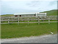
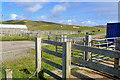
Hosta Cattle Pens
These pens are used by the local crofters and also for the annual cattle show.Thanks to Ian Bramwell, who lives locally, for the information.
Image: © Dave Fergusson
Taken: 21 May 2007
0.18 miles
5
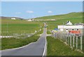
Along the A865
This largely single track 'A' road takes a scenic course around the island from the south west side to the north east. Much of the land to either side in this view comprises machair which is largely windblown sand.
Image: © Gordon Hatton
Taken: 23 Jun 2019
0.20 miles
7
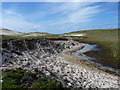
The burn that drains Loch Hosta
Presumably the Abhainn Hosta, although it's unnamed on the OS maps. Here, it cuts through the dunes behind Tràigh Stir onto the beach.
Image: © Richard Law
Taken: 15 Apr 2012
0.25 miles