
IMAGES TAKEN NEAR TO
Kendebig, ISLE OF HARRIS, HS3 3DZ
Introduction
This page details the photographs taken nearby to HS3 3DZ by members of the Geograph project.
The Geograph project started in 2005 with the aim of publishing, organising and preserving representative images for every square kilometre of Great Britain, Ireland and the Isle of Man.

There are currently over 7.5m images from over14,400 individuals and you can help contribute to the project by visiting https://www.geograph.org.uk
Image Map
Images are licensed for reuse under creativecommons.org/licenses/by-sa/2.0
Notes
- Clicking on the map will re-center to the selected point.
- The higher the marker number, the further away the image location is from the centre of the postcode.
Image Listing (19 Images Found)
Images are licensed for reuse under creativecommons.org/licenses/by-sa/2.0
Image
Details
Distance
1
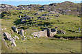
Former mill at Miabhaig
View from upstream.
Image: © Mike Pennington
Taken: 26 Jul 2011
0.06 miles
3
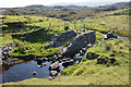
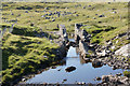
Former mill at Miabhaig
The mill was certainly still in operation in 1911 when it was operated by a family named Macaulay, ancestors of the photographer's wife.
Image: © Mike Pennington
Taken: 26 Jul 2011
0.06 miles
4
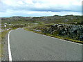
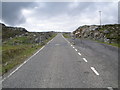
The Golden Road
Heading south towards Miabhaig.
Image: © Dave Fergusson
Taken: 29 Jun 2011
0.07 miles
5
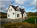
Aisling Cottage
Close to all local amenities and the beautiful white sandy beaches of South Harris Aisling Cottage is the ideal location from which to explore. We stayed here for 2 weeks.
Image: © Rude Health
Taken: 25 Sep 2013
0.10 miles
7
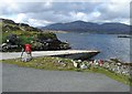
Slipway at Miavaig
This local authority-owned slipway leads into Loch Ceann Dibig and is mainly used by leisure craft.
Image: © Bob Jones
Taken: 20 May 2006
0.14 miles
8
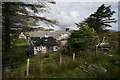
Dilapidating house at Miabhaig
This house has rapidly deteriorated in the Hebridean weather.
Image: © carol gill
Taken: 10 Aug 2008
0.14 miles
9
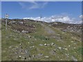
The old road to Tarbert, Harris
The remains of the old road just show here, at a passing place on the newer road, which is still pretty narrow and tortuous - known as "The Golden Road".
Image: © Gordon Brown
Taken: 29 May 2016
0.20 miles
10

Ruined houses beside the jetty at Miabhaig
Image: © Mike Pennington
Taken: 26 Jul 2011
0.20 miles