
IMAGES TAKEN NEAR TO
Carnan Park, ISLE OF LEWIS, HS2 9BW
Introduction
This page details the photographs taken nearby to Carnan Park, HS2 9BW by members of the Geograph project.
The Geograph project started in 2005 with the aim of publishing, organising and preserving representative images for every square kilometre of Great Britain, Ireland and the Isle of Man.

There are currently over 7.5m images from over14,400 individuals and you can help contribute to the project by visiting https://www.geograph.org.uk
Image Map
Images are licensed for reuse under creativecommons.org/licenses/by-sa/2.0
Notes
- Clicking on the map will re-center to the selected point.
- The higher the marker number, the further away the image location is from the centre of the postcode.
Image Listing (3 Images Found)
Images are licensed for reuse under creativecommons.org/licenses/by-sa/2.0
Image
Details
Distance
2
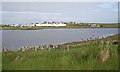
Siabost bho Thuath
Looking across Loch na Muilne to North Shawbost. The white buildings are the tweed mill. Even though it is marked on the map as a tourist attraction, it isn't obvious from outside the building whether visitors are still welcome (I had visited it 39 years earlier).
Image: © Anne Burgess
Taken: 3 Jun 2009
0.09 miles
3
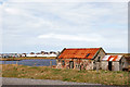
Loch na Muilna
This loch sits between the Harris tweed mill in the background and the main road into Shawbost on the west side of the Isle of Lewis.
Image: © Stephen Branley
Taken: 22 Apr 2009
0.22 miles