IMAGES TAKEN NEAR TO
Barvas Road, ISLE OF LEWIS, HS2 0SD
Introduction
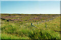
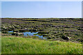
This page details the photographs taken nearby to Barvas Road, HS2 0SD by members of the Geograph project.
The Geograph project started in 2005 with the aim of publishing, organising and preserving representative images for every square kilometre of Great Britain, Ireland and the Isle of Man.

There are currently over 7.5m images from over14,400 individuals and you can help contribute to the project by visiting https://www.geograph.org.uk
Image Map
Images are licensed for reuse under creativecommons.org/licenses/by-sa/2.0
Notes
- Clicking on the map will re-center to the selected point.
- The higher the marker number, the further away the image location is from the centre of the postcode.
Image Listing (3 Images Found)
Images are licensed for reuse under creativecommons.org/licenses/by-sa/2.0
Image
Details
Distance
1
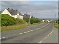
Houses beside the A857
These whitewashed houses are the last houses you will pass before heading out into the Barvas moor towards the West side of Lewis. They are within the Blackwater district of the island.
Image: © Donald Lawson
Taken: 21 Jul 2006
0.06 miles