
IMAGES TAKEN NEAR TO
Back, ISLE OF LEWIS, HS2 0NA
Introduction
This page details the photographs taken nearby to HS2 0NA by members of the Geograph project.
The Geograph project started in 2005 with the aim of publishing, organising and preserving representative images for every square kilometre of Great Britain, Ireland and the Isle of Man.

There are currently over 7.5m images from over14,400 individuals and you can help contribute to the project by visiting https://www.geograph.org.uk
Image Map
Images are licensed for reuse under creativecommons.org/licenses/by-sa/2.0
Notes
- Clicking on the map will re-center to the selected point.
- The higher the marker number, the further away the image location is from the centre of the postcode.
Image Listing (4 Images Found)
Images are licensed for reuse under creativecommons.org/licenses/by-sa/2.0
Image
Details
Distance
1
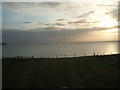
Morning view from Broad Bay House, Bac, Lewis
Image: © Peter Barr
Taken: 24 Sep 2009
0.03 miles
2
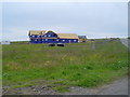
New Home east of B895
This large new house is being constructed on a croft between the B895 and Broad Bay. This area has only recently been built upon and several houses are being built at the moment. The cheap land prices in the islands mean that more money is left to build larger houses.
Image: © Donald Lawson
Taken: 1 Jul 2006
0.04 miles
3
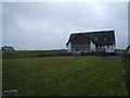
Broad Bay House
Seriously good accommodation... 5 star
Image: © Peter Barr
Taken: 23 Sep 2009
0.06 miles
4
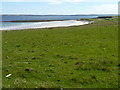
Grass beside the beach
With the sunlit sands of Tràigh Rèbac in the distance.
Image: © James Allan
Taken: 26 May 2013
0.17 miles