
IMAGES TAKEN NEAR TO
Newmarket, ISLE OF LEWIS, HS2 0DT
Introduction
This page details the photographs taken nearby to HS2 0DT by members of the Geograph project.
The Geograph project started in 2005 with the aim of publishing, organising and preserving representative images for every square kilometre of Great Britain, Ireland and the Isle of Man.

There are currently over 7.5m images from over14,400 individuals and you can help contribute to the project by visiting https://www.geograph.org.uk
Image Map
Images are licensed for reuse under creativecommons.org/licenses/by-sa/2.0
Notes
- Clicking on the map will re-center to the selected point.
- The higher the marker number, the further away the image location is from the centre of the postcode.
Image Listing (11 Images Found)
Images are licensed for reuse under creativecommons.org/licenses/by-sa/2.0
Image
Details
Distance
1

Lane with a mix of new and traditional houses
The size of croft houses has grown in recent years and the area around Lacasdail has several very large properties.
Image: © John Haynes
Taken: 9 Jul 2010
0.07 miles
2
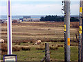
A new house and croft near Newmarket, north of Stornoway
Image: © John Lucas
Taken: 12 Feb 2013
0.10 miles
3

Fenced grazing land
Two crofts with no houses growing reasonable grass which will probably be cut for haylage. If there are stock associated with these two holdings they are probably away on the community grazing.
Image: © John Haynes
Taken: 1 Jan 2009
0.10 miles
4

Lacasdail Community Hall
A recently built community hall, it is a steel framed and sheeted industrial building with internal finish to meet its use.
Image: © John Haynes
Taken: 9 Jul 2010
0.15 miles
5

Community grazing drinking troughs
The grazings are well fenced, with good quality gates and water supplies.
Image: © John Haynes
Taken: 9 Jul 2010
0.16 miles
6
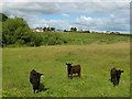
Calves beside Abhainn Lacasdal
The River Laxdale runs across the centre of this photo, just behind and below the fence.
Image: © Eileen Henderson
Taken: 29 Jun 2007
0.18 miles
7
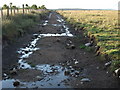
Access track across the grazings
This track begins where the stoned track ends. It has been rolled hard and although there are some large puddles it seems to be stable.
Image: © John Haynes
Taken: 9 Jul 2010
0.19 miles
8

Lacasdail Primary School
A large primary school serving the villages around and the northern side of Steòrnabhagh.Image]
Image: © John Haynes
Taken: 9 Jul 2010
0.21 miles
10
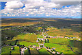
Laxdale
Aerial view of Laxdale (Gaelic - Lacasdail) with the co-ordinates taken from the junior school which is just north of the river.
Image: © Stephen Branley
Taken: 7 Aug 2008
0.21 miles