
IMAGES TAKEN NEAR TO
Rathad An Domhnallaich, STORNOWAY, HS1 2AH
Introduction
This page details the photographs taken nearby to Rathad An Domhnallaich, HS1 2AH by members of the Geograph project.
The Geograph project started in 2005 with the aim of publishing, organising and preserving representative images for every square kilometre of Great Britain, Ireland and the Isle of Man.

There are currently over 7.5m images from over14,400 individuals and you can help contribute to the project by visiting https://www.geograph.org.uk
Image Map
Images are licensed for reuse under creativecommons.org/licenses/by-sa/2.0
Notes
- Clicking on the map will re-center to the selected point.
- The higher the marker number, the further away the image location is from the centre of the postcode.
Image Listing (50 Images Found)
Images are licensed for reuse under creativecommons.org/licenses/by-sa/2.0
Image
Details
Distance
1
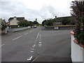
Houses on the northern edge of Ste?rnabhagh
Relatively new houses with big gardens and lots of space all round.
Image: © John Haynes
Taken: 11 Jul 2010
0.05 miles
2
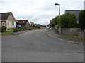
Houses on Rathad a Charraigh Chuimhe
Close by the War Memorial this aptly named road of big houses is Memorial Avenue.
Image: © John Haynes
Taken: 11 Jul 2010
0.10 miles
3
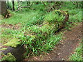
Temperate rainforest on the North-west edge of Europe
Nice example of the growth that will occur once the cover of broad leaved trees is established. This is not ancient rainforest but was established after 1846 when Sir James Matheson bought Leòdhas.
Image]
Image: © John Haynes
Taken: 11 Jul 2010
0.14 miles
4
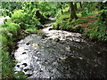
The Bayhead River
The Bayhead River flows through the woodland around Caisteal Leòdhais and eventually flows into Steòrnabhagh harbour.
Image: © John Haynes
Taken: 11 Jul 2010
0.15 miles
5
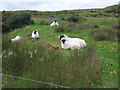
Blackface ewes and lambs
This on the edge of Steòrnabhagh by the War Memorial, typical of the grazing here.
Image: © John Haynes
Taken: 11 Jul 2010
0.16 miles
6
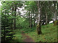
Caisteal Le?dhais woodland pathway
There are not many broad leaved trees on Eilean Leòdhais but when Sir James Matheson bought the island in 1846 the long process began to establish woodland around the castle site. Today the woodland is managed by the community-based Stornoway Trust. Image]
Image: © John Haynes
Taken: 11 Jul 2010
0.16 miles
7
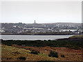
The Lewis War Memorial
Viewed from near the Iolaire monument.
Image: © John Lucas
Taken: 21 Nov 2015
0.16 miles
8
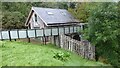
Restored water mill
Original mill on this site was built in 1816 to grind corn.
Image: © Sandy Gerrard
Taken: 5 Sep 2014
0.16 miles
9
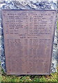
Lewis War Memorial WWI Plaque - Stornoway Parish - Burgh & Central Division (Cont) & Back Division
Image: © John Lucas
Taken: 20 Nov 2015
0.18 miles
10
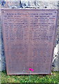
Lewis War Memorial WWI Plaque - Stornoway Parish - Burgh & Central Division (Cont)
Image: © John Lucas
Taken: 20 Nov 2015
0.18 miles