IMAGES TAKEN NEAR TO
Bosbury, LEDBURY, HR8 1HD
Introduction
This page details the photographs taken nearby to HR8 1HD by members of the Geograph project.
The Geograph project started in 2005 with the aim of publishing, organising and preserving representative images for every square kilometre of Great Britain, Ireland and the Isle of Man.

There are currently over 7.5m images from over14,400 individuals and you can help contribute to the project by visiting https://www.geograph.org.uk
Image Map
Images are licensed for reuse under creativecommons.org/licenses/by-sa/2.0
Notes
- Clicking on the map will re-center to the selected point.
- The higher the marker number, the further away the image location is from the centre of the postcode.
Image Listing (15 Images Found)
Images are licensed for reuse under creativecommons.org/licenses/by-sa/2.0
Image
Details
Distance
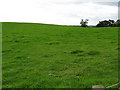
1
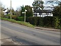
Road junction at Gold Hill
Road junction at Gold Hill on the B4214, the road on the right goes to Catley and Bosbury.
Image: © Philip Halling
Taken: 22 Nov 2020
0.03 miles
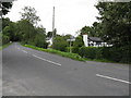
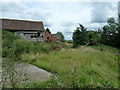
4
Empty barn
By a small unnamed woodland belt near Catley Southfield.
Image: © Pauline E
Taken: 21 Aug 2009
0.15 miles
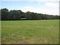
7
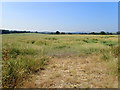
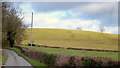
Field of rape
No longer a yellow field
Image: © Eirian Evans
Taken: 28 Jun 2018
0.18 miles
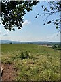
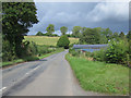
9
Gold Hill
A few seconds earlier this grassy rounded hill did indeed live up to its name.
On this showery morning the best I could do was this.
Image: © Jonathan Billinger
Taken: 6 Jan 2015
0.19 miles
10
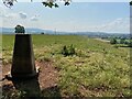
Gold Hill Trig Point Flush Bracket S7286
Image: © thejackrustles
Taken: 4 Aug 2021
0.19 miles