
IMAGES TAKEN NEAR TO
Newbury Park, LEDBURY, HR8 1AX
Introduction
This page details the photographs taken nearby to Newbury Park, HR8 1AX by members of the Geograph project.
The Geograph project started in 2005 with the aim of publishing, organising and preserving representative images for every square kilometre of Great Britain, Ireland and the Isle of Man.

There are currently over 7.5m images from over14,400 individuals and you can help contribute to the project by visiting https://www.geograph.org.uk
Image Map
Images are licensed for reuse under creativecommons.org/licenses/by-sa/2.0
Notes
- Clicking on the map will re-center to the selected point.
- The higher the marker number, the further away the image location is from the centre of the postcode.
Image Listing (142 Images Found)
Images are licensed for reuse under creativecommons.org/licenses/by-sa/2.0
Image
Details
Distance
1
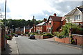
Newbury Park, Ledbury
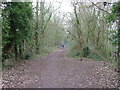
Looking down at the line of trees which mark the old railway line to Gloucester, closed in 1959. Most of the houses are Victorian.
Image: © Julian P Guffogg
Taken: 16 Aug 2011
0.02 miles
4
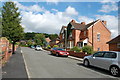
Newbury Park, Ledbury
Looking up to Dog Hill Wood
Image: © Julian P Guffogg
Taken: 16 Aug 2011
0.09 miles
6
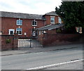
Scout Headquarters in Ledbury
Viewed across the A438 The Homend. The nameboard near the tree shows
1ST LEDBURY SCOUT GROUP HEADQUARTERS.
Image: © Jaggery
Taken: 19 May 2013
0.12 miles
7
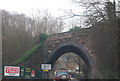
Ex-railway bridge, Ledbury
Bridge for the, now closed, Gloucester branch.
Image: © N Chadwick
Taken: 2 Jan 2011
0.12 miles
8
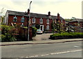
Bethesda Physiotherapy Clinic in Ledbury
Located in Homend Lodge, viewed across the A438 The Homend.
Image: © Jaggery
Taken: 19 May 2013
0.12 miles
9
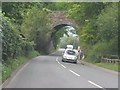
Ledbury - former Gloucester branch bridge
The railway line between Ledbury and Gloucester was a classic country branch line, in this instance replacing a failed canal (1790-1838). It was moribund before World War II, with the then owners actively encouraging passengers to use alternative bus services! The line limped on until 1959 at which point the Ledbury-Dymock section was closed completely, the Dymock-Gloucester section surviving for intermittent freight traffic until 1964.
Image: © J Whatley
Taken: 22 Sep 2010
0.12 miles
10
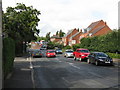
Top of The Homend
The northern end of Ledbury's main north-south thoroughfare with the junction for The Langland housing estate on the left. In the distance, a rail-replacement coach waits for custom on the ramp up to Ledbury railway station.
Image: © Peter Whatley
Taken: 2 Sep 2008
0.13 miles