
IMAGES TAKEN NEAR TO
Milvern Place, BROMYARD, HR7 4UF
Introduction
This page details the photographs taken nearby to Milvern Place, HR7 4UF by members of the Geograph project.
The Geograph project started in 2005 with the aim of publishing, organising and preserving representative images for every square kilometre of Great Britain, Ireland and the Isle of Man.

There are currently over 7.5m images from over14,400 individuals and you can help contribute to the project by visiting https://www.geograph.org.uk
Image Map
Images are licensed for reuse under creativecommons.org/licenses/by-sa/2.0
Notes
- Clicking on the map will re-center to the selected point.
- The higher the marker number, the further away the image location is from the centre of the postcode.
Image Listing (439 Images Found)
Images are licensed for reuse under creativecommons.org/licenses/by-sa/2.0
Image
Details
Distance
1
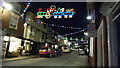
Christmas Lights at Bromyard
The very festive Christmas lights at Bromyard in High Street.
Image: © Fabian Musto
Taken: 4 Jan 2019
0.02 miles
2
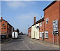
Bromyard 11 miles from Tenbury
The B4214 Tenbury Road viewed from Cruxwell Street Bromyard.
Image: © Jaggery
Taken: 19 Mar 2015
0.02 miles
3
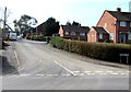
Ballhurst, Bromyard
Viewed across Tenbury Road. Some maps show Ballhurst Road,
but the street name sign (and local estate agents) disagree.
Image: © Jaggery
Taken: 19 Mar 2015
0.02 miles
4
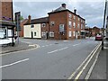
Road junction
T-junction where the B4214 Tenbury Rd. meets the "Old Road" - also the B4214, in Bromyard.
Image: © Mike Dodman
Taken: 9 Jun 2024
0.02 miles
5
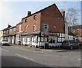
Shun Fat, Bromyard
Not a slimming club, but a Chinese takeaway on the corner of Old Road and Tenbury Road.
Image: © Jaggery
Taken: 19 Mar 2015
0.02 miles
6
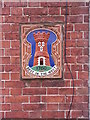
West Country Ales plaque, Cruxwell Street, Bromyard
On a former pub building at the corner of Cruxwell Street and Tenbury Road (http://www.geograph.org.uk/photo/3231619). For more details of the plaque's origins, see: http://www.gloucestershirepubs.co.uk/WestCountryPlaques/WestCountryPlaques.htm .
Image: © Peter Whatley
Taken: 20 Nov 2012
0.03 miles
7
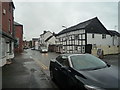
The B4214 Road (Bromyard)
This section of the B4214 road goes through Old Road, and the timber-frame building on the right is by the Roman Catholic church.
Image: © Fabian Musto
Taken: 13 Oct 2019
0.03 miles
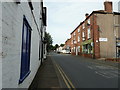
9
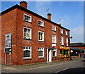
Former White Horse Inn, Bromyard
Now in residential use, the building on the corner of Cruxwell Street and Tenbury Road used to be the White Horse Inn. Ramos Pizza Kebab House http://www.geograph.org.uk/photo/4401475 is on the right.
Image: © Jaggery
Taken: 19 Mar 2015
0.03 miles
10
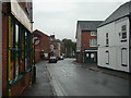
The B4214 Road (Bromyard)
St. Peter's church can be seen in the distance, and the road to the right is High Street.
Image: © Fabian Musto
Taken: 13 Oct 2019
0.03 miles