IMAGES TAKEN NEAR TO
Bredenbury, BROMYARD, HR7 4TG
Introduction
This page details the photographs taken nearby to HR7 4TG by members of the Geograph project.
The Geograph project started in 2005 with the aim of publishing, organising and preserving representative images for every square kilometre of Great Britain, Ireland and the Isle of Man.

There are currently over 7.5m images from over14,400 individuals and you can help contribute to the project by visiting https://www.geograph.org.uk
Image Map
Images are licensed for reuse under creativecommons.org/licenses/by-sa/2.0
Notes
- Clicking on the map will re-center to the selected point.
- The higher the marker number, the further away the image location is from the centre of the postcode.
Image Listing (10 Images Found)
Images are licensed for reuse under creativecommons.org/licenses/by-sa/2.0
Image
Details
Distance
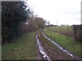
1
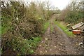
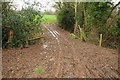
Footpath at Great Wacton
A footpath follows this track, there is a footpath sign, barely visible, on the left in the hedge.
Image: © Philip Halling
Taken: 28 Dec 2015
0.04 miles
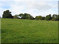
2
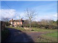
Great Wacton Farm
Viewed from the south.
Image: © Bob Embleton
Taken: 17 Feb 2006
0.04 miles
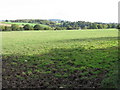
3
Footpath to Great Wacton
A footpath between Great Wacton and Ganderland.
Image: © Philip Halling
Taken: 28 Dec 2015
0.13 miles
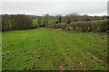
4
Footpath to Ganderland near Great Wacton Farm
Image: © Peter Whatley
Taken: 16 Oct 2008
0.14 miles
6
Old Road to Great Wacton
Looking SW, up hill, towards Great Wacton. The once road from Butterley Mill is now a mere footpath and farm track.
Image: © Bob Embleton
Taken: 17 Feb 2006
0.15 miles
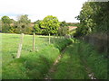
7
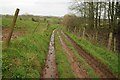
Footpath and track
Footpath and track near Great Wacton.
Image: © Philip Halling
Taken: 28 Dec 2015
0.16 miles
9
Muddy gateway
Muddy gateway near Wacton Green.
Image: © Philip Halling
Taken: 28 Dec 2015
0.21 miles
10
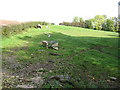
Horses on the footpath to Ganderland
Taken from the bridge across the stream which provides water for the animals.
Image: © Peter Whatley
Taken: 16 Oct 2008
0.21 miles